Wapi Rural LLG
Wapi Rural LLG is a local-level government (LLG) of Morobe Province, Papua New Guinea.[1][2]
Wapi Rural LLG | |
|---|---|
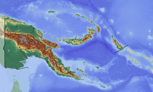
 Wapi Rural LLG Location within Papua New Guinea | |
| Coordinates: 7.239574°S 146.06535°E | |
| Country | Papua New Guinea |
| Province | Morobe Province |
| Time zone | UTC+10 (AEST) |
Wards
- 01. Watama
- 02. Hanjua
- 03. Wauwoka
- 04. Womei
- 05. Tamoi
- 06. Yakepa
- 07. Akwanja
- 08. Taupa
- 09. Mabukapu
- 10. Aiyogi
- 11. Sikwong 1
- 12. Sikwong 2
- 13. Kapini
- 14. Himerka
- 15. Gebgya
gollark: Oh, come to think of it, it would be cool if potatOS could do P2P update if there's no internet connection somehow. Which is probably one of the things git is designed for. Hmmm.
gollark: I have backups of various older versions of it, too.
gollark: No, there are just a lot of files on pastebin and it's hard to track down all the places potatOS randomly downloads things.
gollark: ... if I can find it, actually.
gollark: Anyway, I figure I'll start on the whole project *now* by creating a folder™ containing all the potatOS code.
References
- "Census Figures by Wards - Momase Region". www.nso.gov.pg. 2011 National Population and Housing Census: Ward Population Profile. Port Moresby: National Statistical Office, Papua New Guinea. 2014.
- "Final Figures". www.nso.gov.pg. 2011 National Population and Housing Census: Ward Population Profile. Port Moresby: National Statistical Office, Papua New Guinea. 2014.
- OCHA FISS (2018). "Papua New Guinea administrative level 0, 1, 2, and 3 population statistics and gazetteer". Humanitarian Data Exchange. 1.31.9.
- United Nations in Papua New Guinea (2018). "Papua New Guinea Village Coordinates Lookup". Humanitarian Data Exchange. 1.31.9.
This article is issued from Wikipedia. The text is licensed under Creative Commons - Attribution - Sharealike. Additional terms may apply for the media files.