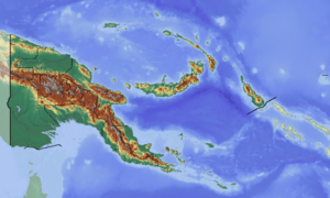
Hube Rural LLG
Hube Rural LLG is a local-level government (LLG) of Morobe Province, Papua New Guinea.[1][2]
Hube Rural LLG | |
|---|---|
 Hube Rural LLG Location within Papua New Guinea | |
| Coordinates: 6.444309°S 147.518031°E | |
| Country | Papua New Guinea |
| Province | Morobe Province |
| Time zone | UTC+10 (AEST) |
Wards
- 17. Pindiu Station
- 18. Tireng
- 19. Unsesu
- 20. Gemaheng
- 21. Sembang (Sofifi)
- 22. Sanangac
- 23. Zaningu
- 24. Homoneng
- 25. Morago
- 26. Besibong
- 27. Pindiu Station
- 28. Zenguru
- 29. Qwakugu
- 30. Genna
- 31. Gaeng
- 32. Sofifi
gollark: Literally just using a calculator > manually doing quadratics.
gollark: You can also differentiate it, using calculululus.
gollark: Completing the square is more general. You can use it to derive the quadratic formula.
gollark: Too bad.
gollark: You can complete the square on it to get that.
References
- "Census Figures by Wards - Momase Region". www.nso.gov.pg. 2011 National Population and Housing Census: Ward Population Profile. Port Moresby: National Statistical Office, Papua New Guinea. 2014.
- "Final Figures". www.nso.gov.pg. 2011 National Population and Housing Census: Ward Population Profile. Port Moresby: National Statistical Office, Papua New Guinea. 2014.
- OCHA FISS (2018). "Papua New Guinea administrative level 0, 1, 2, and 3 population statistics and gazetteer". Humanitarian Data Exchange. 1.31.9.
- United Nations in Papua New Guinea (2018). "Papua New Guinea Village Coordinates Lookup". Humanitarian Data Exchange. 1.31.9.
This article is issued from Wikipedia. The text is licensed under Creative Commons - Attribution - Sharealike. Additional terms may apply for the media files.