Wannanup
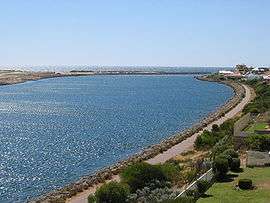
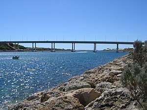
Wannanup (also known as Port Bouvard, Avalon and Florida[2]) is a residential suburb in Western Australia, located 12 kilometres (7 mi) southwest of Mandurah and 87 kilometres (54 mi) south-southwest of the state capital, Perth. It is surrounded on three sides by water — the Indian Ocean to the west, the Harvey Estuary to the east and the Dawesville Channel to the south — and is home to the Port Bouvard development. It is one of four suburbs which lie on an island created by the building of the Dawesville Channel.
| Wannanup Mandurah, Western Australia | |||||||||||||||
|---|---|---|---|---|---|---|---|---|---|---|---|---|---|---|---|
 The Dawesville Channel forms the southern boundary of Wannanup, which lies to the right of the channel in this image | |||||||||||||||
| Population | 3,621 (2016 census)[1] | ||||||||||||||
| • Density | 1,393/km2 (3,610/sq mi) | ||||||||||||||
| Established | 1996 | ||||||||||||||
| Postcode(s) | 6210 | ||||||||||||||
| Area | 2.6 km2 (1.0 sq mi) | ||||||||||||||
| Location |
| ||||||||||||||
| LGA(s) | City of Mandurah | ||||||||||||||
| State electorate(s) | Dawesville | ||||||||||||||
| Federal Division(s) | Canning | ||||||||||||||
| |||||||||||||||
History
Wannanup is the original Aboriginal name for the suburb known as Florida. However, upon the development of the Dawesville Channel, the suburb was split in half. The southern section was placed in Dawesville while the northern section was regazetted as Wannanup in 1996.[3]
The 21st Century has seen the landscape of Wannanup transformed, with the development of Port Bouvard transforming the community from that of a sleepy fishing settlement to a commuter suburb and holiday destination. The Northport estate to the suburb's west lies close to Avalon and Village beaches and consists of modern townhouses based around a small shopping centre surrounded by a network of canals and modern mansions. Meanwhile, the Eastport estate is home to the Port Bouvard Marina, which is a popular area for activities such as boating and fishing.
Demographics

At the 2011 census, Wannanup had a population of 2,769[4] - up from 1,958 people in the 2006 census[5] —and essentially tripling in size since the 2001 census (where 754 people were recorded).[6]
Politics
Wannanup is located within the federal seat of Canning, currently held by Liberal Party member Andrew Hastie, and within the state seat of Dawesville, currently held by Zak Kirkup.
The suburb does not have a polling place of its own, but at the nearby polling place at Dawesville, the two-party preferred vote favours the Liberal Party over the Labor Party. At federal level, the Liberals achieved 64.41% in 2004, 59.46% in 2007 and 58.33% in 2010.[7] At the 2008 state election, the Liberals received 63.02% (up from 55.72% in 2005) of the two-party preferred vote at Dawesville from a primary vote of 58.05% (up from 43.83% for the Liberals and 9.26% for the Nationals).[8]
At local level, Wannanup is located within the Coastal Ward of the City of Mandurah, and is represented by three councillors: Bruce Blay (first elected 2006), Don Pember (elected 2007) and Rhys Williams (elected 2009).[9]
Transport
Wannanup is bisected by Old Coast Road in a similar manner to neighbouring suburbs Falcon and Dawesville. Transperth routes 592, 593 and 594 frequently service the suburb. 592 runs six days a week through the Northport portion of Wannanup while 593 and 594 go straight through the suburb via Old Coast Road and run 7 days a week. Services generally run every twenty minutes during peak hour with 592 and 594 alternating every ten minutes in terms of departing Mandurah Station with some school specials deviating from this normal pattern.
References
- Australian Bureau of Statistics (27 June 2017). "Wannanup (State Suburb)". 2016 Census QuickStats. Retrieved 14 January 2018.

- See - Murray, Ian, with Marion Hercock (2008) Where on the coast is that? Carlisle, W.A. : Hesperian Press. ISBN 978-0-85905-452-2. page 107 for the history of the names of the locality - Florida was the unofficial name in the 1950s, it was proposed to be Caddadup, but was called Florida after 1980
- "Wannanup". City of Mandurah. Retrieved 8 October 2011.
- Australian Bureau of Statistics (31 October 2012). "2011 Community Profiles: Wannanup (State Suburb)". 2011 Census of Population and Housing. Retrieved 26 September 2012.

- Australian Bureau of Statistics (25 October 2007). "Community Profile Series : Wannanup (State Suburb)". 2006 Census of Population and Housing. Retrieved 29 June 2007.
- Australian Bureau of Statistics (19 November 2002). "Community Profile Series : Wannanup (State Suburb)". 2001 Census of Population and Housing. Retrieved 29 June 2007.
- Australian Electoral Commission (AEC) (26 August 2010). "Polling Place - Dawesville". Retrieved 3 September 2011.
- Western Australian Electoral Commission (February 2006). 2005 State General Election Results and Statistics: District Results (PDF). Retrieved 4 September 2011.
- City of Mandurah. "Councillors". Retrieved 4 September 2011.