Union Township, Ohio County, Indiana
Union Township is one of four townships in Ohio County, Indiana, United States. As of the 2010 census, its population was 504 and it contained 219 housing units.[1]
Union Township | |
|---|---|
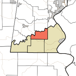 Location in Ohio County | |
| Coordinates: 38°59′16″N 84°58′01″W | |
| Country | |
| State | |
| County | Ohio |
| Government | |
| • Type | Indiana township |
| Area | |
| • Total | 11.61 sq mi (30.1 km2) |
| • Land | 11.52 sq mi (29.8 km2) |
| • Water | 0.09 sq mi (0.2 km2) 0.78% |
| Elevation | 623 ft (190 m) |
| Population (2010) | |
| • Total | 504 |
| • Density | 43.7/sq mi (16.9/km2) |
| ZIP codes | 47001, 47018, 47040 |
| GNIS feature ID | 453927 |
Geography
According to the 2010 census, the township has a total area of 11.61 square miles (30.1 km2), of which 11.52 square miles (29.8 km2) (or 99.22%) is land and 0.09 square miles (0.23 km2) (or 0.78%) is water.[1] Union is the smallest township by area in the state.
Unincorporated towns
(This list is based on USGS data and may include former settlements.)
School districts
- Rising Sun-Ohio County Community Schools
Political districts
- State House District 68
- State Senate District 43
gollark: Easy. Many goals a god could have would be harder to achieve if there were other gods interfering. So obviously they would immediately engage in wars of extermination.
gollark: That just pushes the problem up a level.
gollark: I do not understand your sentence.
gollark: We do know how the world (the Earth, that is) was created. We don't know how the universe came into existence, but you have exactly the same issue with a god.
gollark: It might actually be worse in that case, because at least for the universe thing you can just lean on the anthropic principle - if things *had* gone differently such that we did not exist, we would not be here to complain about it.
References
- "Union Township, Ohio County, Indiana". Geographic Names Information System. United States Geological Survey. Retrieved 2009-10-22.
- United States Census Bureau 2009 TIGER/Line Shapefiles
- IndianaMap
- "Population, Housing Units, Area, and Density: 2010 - County -- County Subdivision and Place -- 2010 Census Summary File 1". United States Census. Archived from the original on 2020-02-12. Retrieved 2013-05-10.
External links
- Indiana Township Association
- United Township Association of Indiana
- City-Data.com page for Union Township
Places adjacent to Union Township, Ohio County, Indiana | |
|---|---|
Municipalities and communities of Ohio County, Indiana, United States | ||
|---|---|---|
| City | Map of Indiana highlighting Ohio County | |
| Townships | ||
| Unincorporated communities | ||
This article is issued from Wikipedia. The text is licensed under Creative Commons - Attribution - Sharealike. Additional terms may apply for the media files.