Randolph Township, Ohio County, Indiana
Randolph Township is one of four townships in Ohio County, Indiana, United States. As of the 2010 census, its population was 4,383 and it contained 2,033 housing units.[1]
Randolph Township | |
|---|---|
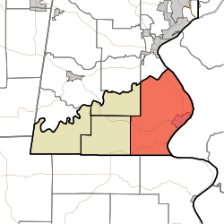 Location in Ohio County | |
| Coordinates: 38°56′47″N 84°53′45″W | |
| Country | |
| State | |
| County | Ohio |
| Government | |
| • Type | Indiana township |
| Area | |
| • Total | 38.54 sq mi (99.8 km2) |
| • Land | 37.34 sq mi (96.7 km2) |
| • Water | 1.21 sq mi (3.1 km2) 3.14% |
| Elevation | 518 ft (158 m) |
| Population (2010) | |
| • Total | 4,383 |
| • Density | 117.4/sq mi (45.3/km2) |
| ZIP codes | 47001, 47040 |
| GNIS feature ID | 453780 |
Geography
According to the 2010 census, the township has a total area of 38.54 square miles (99.8 km2), of which 37.34 square miles (96.7 km2) (or 96.89%) is land and 1.21 square miles (3.1 km2) (or 3.14%) is water.[1] The Ohio River defines the township's eastern border.
Cities, towns, villages
Unincorporated towns
- Buffalo at 39.020614°N 84.883839°W
- Camp Shor at 38.998115°N 84.849116°W
- Norths Landing at 38.902283°N 84.873560°W
(This list is based on USGS data and may include former settlements.)
Cemeteries
The township contains these three cemeteries: Cedar Hedge, LaGrange and Rising Sun.
Major highways
School districts
- Rising Sun-Ohio County Community Schools
Political districts
- State House District 68
- State Senate District 43
gollark: You can even run ArchLinuxARM on a Raßpberry Pi!
gollark: But Hannah Montana Linux is the Hannah Montana of Linux.
gollark: Canonical is the Microsoft of Linux.
gollark: It can and he is a WRONG dodecagon.
gollark: I'm not sure why you would expect it to.
References
- "Randolph Township, Ohio County, Indiana". Geographic Names Information System. United States Geological Survey. Retrieved 2009-10-22.
- United States Census Bureau 2009 TIGER/Line Shapefiles
- IndianaMap
- "Population, Housing Units, Area, and Density: 2010 - County -- County Subdivision and Place -- 2010 Census Summary File 1". United States Census. Archived from the original on 2020-02-12. Retrieved 2013-05-10.
External links
- Indiana Township Association
- United Township Association of Indiana
- City-Data.com page for Randolph Township
Places adjacent to Randolph Township, Ohio County, Indiana | |
|---|---|
Municipalities and communities of Ohio County, Indiana, United States | ||
|---|---|---|
| City | Map of Indiana highlighting Ohio County | |
| Townships | ||
| Unincorporated communities | ||
This article is issued from Wikipedia. The text is licensed under Creative Commons - Attribution - Sharealike. Additional terms may apply for the media files.