Toftrees
Toftrees is a hamlet within the civil parish of Dunton in the English county of Norfolk.[1] The hamlet is 2.3 miles south west of Fakenham, 27.3 miles north west of Norwich and 113 miles north north east of London. The nearest railway station is at Sheringham for the Bittern Line which runs between Sheringham, Cromer and Norwich. The nearest airport is Norwich International Airport. The village is situated on the north west side of the A1065 Fakenham to Swaffham road.[2] The parish had in 2001 census, a population of 115. For the purposes of local government, the parish falls within the district of North Norfolk.
| Toftrees | |
|---|---|
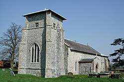 The parish church of All Saints, Toftrees, Norfolk | |
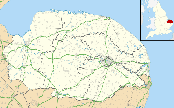 Toftrees Location within Norfolk | |
| Population | 115 (parish, 2001 census) |
| OS grid reference | TF890270 |
| • London | 113 miles (182 km) |
| Civil parish |
|
| District | |
| Shire county | |
| Region | |
| Country | England |
| Sovereign state | United Kingdom |
| Post town | FAKENHAM |
| Postcode district | NR21 |
| Dialling code | 01328 |
| Police | Norfolk |
| Fire | Norfolk |
| Ambulance | East of England |
| UK Parliament | |
History
There is evidence that there has been a settlement here from Roman times as it is located at a junction of Roman roads or trackways.
Toftrees has an entry in the Domesday Book of 1086[3] In the great book Toftrees is recorded by the names Toffas, and Toftes, the main landholders being William de Warenne and Peter de Valognes. The survey also mentions the church and there are said to be 12 wild mares.
References
- OS Explorer Map 24 - Norfolk Coast Central ISBN 0-319-21726-4
- County A to Z Atlas, Street & Road maps Norfolk, p. 227, ISBN 978-1-84348-614-5
- The Domesday Book, England's Heritage, Then and Now, Editor: Thomas Hinde, Norfolk, p. 195, Toftrees, ISBN 1-85833-440-3