Tisá
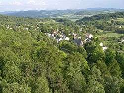
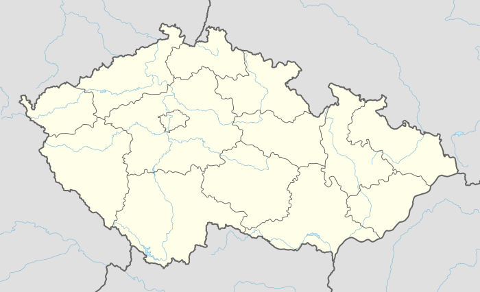
Tisá (German: Tissa, earlier also Tyssa) is a village, which belongs to the Ústí nad Labem Region of the Czech Republic. The municipality covers an area of 11.85 square kilometres and has a population of 918 as of 2013. Tisá lies approximately 15 kilometres (9 mi) north of Ústí nad Labem and 84 km (52 mi) north of Prague and 3 kilometres (2 mi) south of borders with Germany. The village is situated in 548 – 550 meters above sea level.[1]
Tisá | |
|---|---|
Municipality | |
 | |
 Flag  Coat of arms | |
 Tisá | |
| Coordinates: 50°47′30″N 14°1′5″E | |
| Country | |
| Region | Ústí nad Labem |
| District | Ústí nad Labem |
| Area | |
| • Total | 11.85 km2 (4.58 sq mi) |
| Elevation | 548 m (1,798 ft) |
| Population (2013) | |
| • Total | 918 |
| • Density | 77/km2 (200/sq mi) |
| Postal code | 403 36 |
| Website | http://www.tisa.cz |
History
Around the year of 500 a group of the Slavs came to the village. The origin of the name is from the Czech word "tis", meaning yew. In the 14th century the Vantenberks usurped an extensive area around Tetschen (Czech: Děčín) and built a stronghold named Šenov. Under the region of knights of Bünau (Czech: Bynov) there was a major economic expansion. In 1554 – 1557 Günter I developed a castle with a Lutheran church, presbytery, school, brewery and the name of the village was changed due to the castle into Schönstein. In 1631 Croatians and Swedes burned all of the objects in Tisá and Schönstein. In 1750 several factories were built, and the city became a cradle of the button industry.[2]
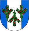
Today the municipal office of Tisá administers two other villages, Ostrov and Rájec. Since 1998 their coat of arms has been represented by three small yew branches.
Nature

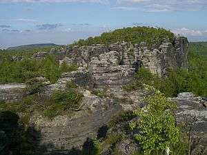
Tisá and neighbouring villages are protected by CHKO Labské pískovce (Conservation area of Elbe sandstones). There is a part of an extensive sandstone plateau that originated about 90 million years ago in the Cretaceous Mesozoic period. When the sea covering the northern part of the country retreated, it left layers of sandstone sediments cemented with kaolin, clay and other materials. Of note is Tyssaer Wände (English: Tyssa Walls).[3]
There are 113 registered climbing routes, a number of bicycle or cross-country skiing ways.
Places of interest
- St Anne’s Church is situated in the centre of the village. This Baroque building was built in 1789. In the frontage of the east tower there are two cast-iron bells from 1922 made by steelmaker from Chabařovice Arnold-Kress and a small bell from 1859 by Harold Francis of Litoměřice (German: Leitmeritz).
- Chapel
- Crucifix of conciliation is placed by the road between Libouchec and Nový Libouchec. On both sides of the wedge-shaped sandstone the year of 1626 has been engraved. It reminds of the time and place of an itinerant quack’s violent death.[3]
References
| Wikimedia Commons has media related to Tisá. |
- Archived December 4, 2008, at the Wayback Machine
- "Historie obce: Obec Tisá". tisa.cz (in Czech). 18 April 2012. Retrieved 9 November 2014.