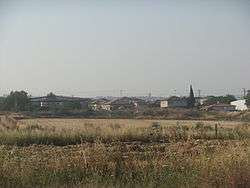
Tirat Yehuda
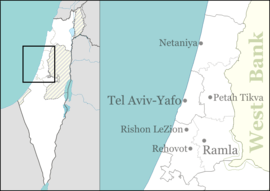
Tirat Yehuda (Hebrew: טִירַת יְהוּדָה, lit. Judah's Castle) is a moshav in central Israel. Located near Yehud and Ben Gurion International Airport, it falls under the jurisdiction of Hevel Modi'in Regional Council. In 2018 it had a population of 1,189.[1]
Tirat Yehuda | |
|---|---|
 | |
 Tirat Yehuda | |
| Coordinates: 32°0′47.51″N 34°55′57.36″E | |
| Grid position | 143/157 PAL |
| Country | Israel |
| District | Central |
| Council | Hevel Modi'in |
| Affiliation | Hapoel HaMizrachi |
| Founded | 1949 |
| Founded by | Hungarian Jewish immigrants |
| Population (2018)[1] | 1,189 |
History
The moshav was established in 1949 by Jewish immigrants from Hungary. Initially, it was located northeast of its present site, in the area which is today Bareket, before moving to its current location in 1951. It was named after the nearby depopulated Palestinian village of al-Tira on which land it was located,[2] and the fact that it was in the vicinity of the border of the land of the Tribe of Judah.
In its first years, it was attacked several times by the Palestinian fedayeen, and was a designated border settlement until the 1967 Six-Day War.
References
| Wikimedia Commons has media related to Tirat Yehuda. |
- "Population in the Localities 2018" (XLS). Israel Central Bureau of Statistics. 25 August 2019. Retrieved 26 August 2019.
- Khalidi, Walid (1992). All That Remains: The Palestinian Villages Occupied and Depopulated by Israel in 1948. Washington D.C.: Institute for Palestine Studies. p. 418. ISBN 0-88728-224-5.