Tikhol Dam
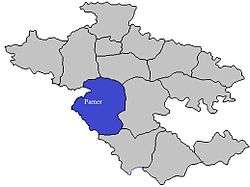
Tikhol Dam (Marathi: तिखोल धरण) is an earth-fill dam on Kalu river in Tikhol village in Parner taluka of Ahmednagar district of state of Maharashtra in India.
| Tikhol Dam | |
|---|---|
 Location of Tikhol Dam in Maharashtra | |
| Official name | Tikhol Dam |
| Location | Tikhol, Parner India |
| Coordinates | 19°8′31″N 74°25′28″E |
| Opening date | 1975 |
| Owner(s) | Government of Maharashtra, India |
| Dam and spillways | |
| Type of dam | Earth-fill (Earthen) |
| Impounds | Kalu River |
| Height | 18.53 m (60.8 ft) |
| Length | 360 m (1,180 ft) |
| Reservoir | |
| Creates | Tikhol lake |
| Total capacity | 1,700 km3 (410 cu mi) |
| Surface area | 64 km2 (25 sq mi) |
Specifications
The height of the dam above lowest foundation is 18.53 m (60.8 ft) while the length is 360 m (1,180 ft). The gross storage capacity is 2,430 km3 (580 cu mi).[1]
Purpose
- Irrigation
- Drinking water for neatest villages
gollark: What's a brachyuraform?
gollark: Why not port PotatOS to x86 instead?
gollark: Interesting.
gollark: firecubez, what are you δoing?
gollark: For purposes.
See also
- Dams in Maharashtra
References
- Specifications of large dams in India Archived 2011-07-21 at the Wayback Machine
Ahmednagar district topics | ||
|---|---|---|
| History | 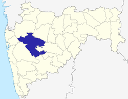 | |
| Geography | ||
| Talukas | ||
| Cities and towns | ||
| Monuments | ||
| Education |
| |
| Lok Sabha constituencies | ||
| Vidhan Sabha constituencies | ||
| Dams in District | ||
This article is issued from Wikipedia. The text is licensed under Creative Commons - Attribution - Sharealike. Additional terms may apply for the media files.