Darodi
Darodi is a village in Parner taluka in Ahmednagar district of state of Maharashtra, India.[1]
Darodi | |
|---|---|
Village | |
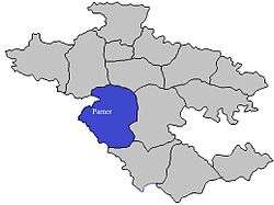
 Darodi Location in Maharashtra, India  Darodi Darodi (India) | |
| Coordinates: 19.081262°N 74.291010°E | |
| Country | |
| State | Maharashtra |
| District | Ahmadnagar |
| Government | |
| • Type | Panchayati raj (India) |
| • Body | Gram panchayat |
| Languages | |
| • Official | Marathi |
| Time zone | UTC+5:30 (IST) |
| Telephone code | 022488 |
| ISO 3166 code | IN-MH |
| Vehicle registration | MH-16,17 |
| Lok Sabha constituency | Ahmednagar |
| Vidhan Sabha constituency | Parner |
| Website | maharashtra |
Religion
The majority of the population in the village are Marathas.
Economy
The majority of the population has farming as their primary occupation. The majority of people are now situated at Mumbai or surrounding areas for job purposes.
gollark: Hmm, what *is* my laptop doing?
gollark: Um, power asymmetry, and my general preference toward not restricting freedoms wherever possible.
gollark: They may, however, have a common root cause.
gollark: It shouldn't be.
gollark: Oh bees my laptop is being bees.
See also
- Villages in Parner taluka
References
This article is issued from Wikipedia. The text is licensed under Creative Commons - Attribution - Sharealike. Additional terms may apply for the media files.