Thung Hua Chang District
Thung Hua Chang (Thai: ทุ่งหัวช้าง, pronounced [tʰûŋ hǔa̯ t͡ɕʰáːŋ]) is a district (amphoe) of Lamphun Province, northern Thailand.
Thung Hua Chang ทุ่งหัวช้าง | |
|---|---|
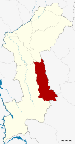 District location in Lamphun Province | |
| Coordinates: 18°0′11″N 99°1′40″E | |
| Country | Thailand |
| Province | Lamphun |
| Seat | Thung Hua Chang |
| Area | |
| • Total | 486.1 km2 (187.7 sq mi) |
| Population (2005) | |
| • Total | 19,067 |
| • Density | 39.2/km2 (102/sq mi) |
| Time zone | UTC+7 (ICT) |
| Postal code | 51160 |
| Geocode | 5105 |
History
The minor district (king amphoe) Thung Hua Chang was created on 1 February 1987, when three tambons were split off from Li District.[1] It was upgraded to a full district on 4 November 1993.[2]
Geography
Neighboring districts are (from the west clockwise): Li, Ban Hong, and Mae Tha of Lamphun Province; Soem Ngam and Thoen of Lampang Province.
The Khun Tan Range stretches from north to south along the district.
Administration
The district is divided into three sub-districts (tambons), which are further subdivided into 35 villages (mubans). Thung Hua Chang is a township (thesaban tambon) which covers parts of the same-named tambon. There are a further three tambon administrative organizations (TAO).
| No. | Name | Thai name | Villages | Pop. | |
|---|---|---|---|---|---|
| 1. | Thung Hua Chang | ทุ่งหัวช้าง | 12 | 8,294 | |
| 2. | Ban Puang | บ้านปวง | 11 | 3,918 | |
| 3. | Takhian Pom | ตะเคียนปม | 12 | 6,855 |
References
- ประกาศกระทรวงมหาดไทย เรื่อง แบ่งท้องที่อำเภอลี้ จังหวัดลำพูน ตั้งเป็นกิ่งอำเภอทุ่งหัวช้าง (PDF). Royal Gazette (in Thai). 94 (11 ง): 488. February 8, 1987.
- พระราชกฤษฎีกาตั้งอำเภอลำทับ อำเภอร่องคำ อำเภอเวียงแหง อำเภอนาโยง อำเภอแก้งสนามนาง อำเภอโนนแดง อำเภอบ้านหลวง อำเภอกะพ้อ อำเภอศรีบรรพต อำเภอแก่งกระจาน อำเภอหนองสูง อำเภอสบเมย อำเภอเมยวดี อำเภอโคกเจริญ อำเภอทุ่งหัวช้าง อำเภอผาขาว อำเภอวังหิน อำเภอดอนพุด อำเภอบึงโขงหลง และอำเภอห้วยคต พ.ศ. ๒๕๓๖ (PDF). Royal Gazette (in Thai). 110 (179 ก special): 1–3. November 3, 1993.