Ban Hong District
Ban Hong (Thai: บ้านโฮ่ง, pronounced [bâːn hôːŋ]) is a district (amphoe) of Lamphun Province, northern Thailand.
Ban Hong บ้านโฮ่ง | |
|---|---|
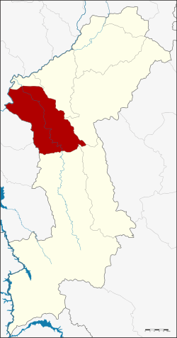 District location in Lamphun Province | |
| Coordinates: 18°19′52″N 98°49′8″E | |
| Country | Thailand |
| Province | Lamphun |
| Area | |
| • Total | 596.9 km2 (230.5 sq mi) |
| Population (2005) | |
| • Total | 42,697 |
| • Density | 71.5/km2 (185/sq mi) |
| Time zone | UTC+7 (ICT) |
| Postal code | 51130 |
| Geocode | 5103 |
History
The minor district (king amphoe) Ban Hong was established in 1917, when it was split off from Pa Sang District. It was upgraded to a full district on 24 June 1956.[1]
Geography
Neighboring districts are (from the north clockwise): Wiang Nong Long, Pa Sang, Mae Tha, Thung Hua Chang and Li of Lamphun Province, Hot and Chom Thong of Chiang Mai Province .
Administration
The district is divided into five sub-districts (tambons), which are further subdivided into 59 villages (mubans). Ban Hong is a township (thesaban tambon) which covers parts of tambon Ban Hong. There are a further five tambon administrative organizations (TAO).
| No. | Name | Thai name | Villages | Pop. | |
|---|---|---|---|---|---|
| 1. | Ban Hong | บ้านโฮ่ง | 18 | 15,186 | |
| 2. | Pa Phlu | ป่าพลู | 12 | 7,758 | |
| 3. | Lao Yao | เหล่ายาว | 12 | 9,641 | |
| 4. | Si Tia | ศรีเตี้ย | 9 | 6,031 | |
| 5. | Nong Pla Sawai | หนองปลาสะวาย | 8 | 4,081 |
gollark: Unless you want four turtles for yourself, I mean?
gollark: Well, in that case, you can have your 40KST back.
gollark: Wait, already?
gollark: THEN I need an entity sensor, which is 5 iron ingots.
gollark: THEN I need a turtle, 7 more ingots.
References
- พระราชกฤษฎีกาจัดตั้งอำเภอนาทวี อำเภอสะบ้าย้อย อำเภอคำชะอี อำเภอย่านตาขาว อำเภอวัดโบสถ์ อำเภอหนองบัว อำเภอวัฒนานคร อำเภอแสวงหา อำเภอท่าชนะ อำเภอพระพุทธบาท อำเภอโนนสัง อำเภอบำเหน็จณรงค์ อำเภอคอนสวรรค์ อำเภอบ้านโฮ่ง อำเภอคีรีมาศ อำเภอชนแดน อำเภอแม่แจ่ม อำเภอไทรน้อย และอำเภอบ้านแพง พ.ศ. ๒๔๙๙ (PDF). Royal Gazette (in Thai). 73 (46 ก): 657. June 5, 1956.
This article is issued from Wikipedia. The text is licensed under Creative Commons - Attribution - Sharealike. Additional terms may apply for the media files.