Thornton-le-Dale
Thornton-le-Dale (also called Thornton Dale) is a village and civil parish in the Ryedale district of North Yorkshire, England, about 3 miles (5 km) east of Pickering on the edge of the North York Moors National Park. The area of the village encompasses 39.2 square kilometres.[2]
| Thornton-le-Dale | |
|---|---|
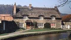
 A traditional cottage, now the Beck Isle museum | |
 Thornton-le-Dale Location within North Yorkshire | |
| Population | 1,759 (2011 Census)[1] |
| OS grid reference | SE834830 |
| District | |
| Shire county | |
| Region | |
| Country | England |
| Sovereign state | United Kingdom |
| Post town | PICKERING |
| Postcode district | YO18 |
| Dialling code | 01751 |
| Police | North Yorkshire |
| Fire | North Yorkshire |
| Ambulance | Yorkshire |
| UK Parliament | |
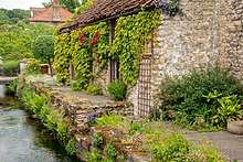
A thatched building, called Beck Isle or Thatched Cottage and Grade II listed, was built in the 17th century and modified/extended in the 20th.[3] The building has appeared on countless calendars and chocolate boxes over the years. A new thatched roof was installed in 2014 so it remains picturesque.[4] A stream, the Thornton Beck, meanders along the streets and is crossed by several bridges. Much of the village was designated as a Conservation Area by the North York Moors.[5] Thornton-le-Dale is often regarded as one of the prettiest in Yorkshire.[6]
The village lies on the A170 road from Thirsk to Scarborough within the National Park. The route of The White Rose Way, a long distance walk from Leeds to Scarborough, also passes through.
History
In the Domesday Book of 1086, the settlement, with a population of 30, appears in three entries; it was then known as Torentune. Other nearby small settlements included Roxby, Farmanby, Thornton, Ellerburn and Leidtorp; four of these eventually joined to become the village.[7] In 1066, the Lord was Earl Morcar and by 1086, the Crown (King William) owned this area;[8] it was later transferred to Count Odo and his wife. By 1281, a Manor was built here, owned by John De Easton. In 1661, the owner was the Hill family; they built a new manor on the site of the old one.[9] A 1921 report indicated the owner as Captain Richard Hill.[10] Known as The Hall, and Grade II listed, the manor is now a residential care home for the elderly. The building's origins are stated as 17th century, "probably with earlier origins".[11][12]
There was a mill on Thornton Beck from at least 1200; the current mill was built in the 18th century. By 1277, there was also a mill at Ellerburn. Weaving was a common industry from the 14th to the 18th century. The beck was diverted in the 19th century when a large mill complex with sluice gates was built.[13]
In the Middle Ages, Roxby, just west of the village, was a separate manor, which fell into the hands of the Cholmeley family in 1499.[14] Sir Hugh Cholmeley, 1st Baronet, was born at Roxby Castle, then known as Thorton-on-the-Hill.[15] The remains on Roxby Hill are a Scheduled Ancient Monument although none of the buildings remain.[16][17] The area is also Grade II listed as "ridge and furrow earthworks [and] cultivation strips".[18]
Richard Rolle, the English hermit mystic, was probably born in Thornton-le-Dale in the 1300s. He authored many books on religious topics.[19]
.jpg)
All Saints' Church, Grade II listed, is centuries old and was altered several times: entirely rebuilt in the 14th century, though some earlier aspects still remain, and modified in 1681 and 1865.[20] The existing copy of the church register includes listings as far back as 1538.[10] Comber House, the former rectory on Church Hill, designed c. 1840 by J. P. Prichett, is also Grade II listed.[21]
St Hilda's Church, Grade II listed, is in the tiny village of Ellerburn which is part of Thornton-le-Dale. The original building dates to the early Norman period, and according to some sources, to the Saxon era, as early as 850 or 1050. It was restored and modified in 1904-1905 and in 1911.[17][22] Today, there are a few other churches in or near Thornton-le-Dale.[23]
In 1670, 12 almshouses and a school were built, thanks to an endowment left by Elizabeth, Viscountess Lumley who had died years earlier;[24] her family had owned much of the land in the area.[25] The buildings, between the village green and the bridge, are supported by the Lady Lumley's Almshouse Trust. In 2014, a major renovation was completed on the 12 bungalows by the Trust on the Grade II listed buildings in 2014. They have been inhabited for some time as age-specific housing.[26] The Old Grammar School had space for 200 students and remained in use until the 20th century; it is now used for other purposes.[27] Another school, the Lady Lumley's School in nearby Pickering, is still in use, as a coeducational secondary school and sixth form. The only current school in Thornton Dale is the CE School school, with 133 students in 2018, operated by the Church of England.[28]
In 1801, the population was 1,041. By 1831, it had increased to 1,368.[29]
The village used to have a railway station on the Forge Valley Line between Seamer and Pickering. The trains first arrived in 1839 but the Pickering-Scarborough branch was not completed here until 1882. Some agricultural workers left the area on the train, seeking paid jobs elsewhere.[30] The Thornton Dale railway station opened in 1882 and closed to passengers in 1950, with a freight train from a quarry in the village continuing to use the tracks until 1964.[31] After being used for several purposes, including offices and a caravan park, the station was converted into three holiday rental cottages.[32]
Governance
The parish is in the Ryedale District electoral ward of Thornton Dale, which extends beyond the boundaries of the Parish with a total population of 3,256 at the 2011 census.[33]
For county council purposes the parish is in the Thornton Dale and the Wolds electoral division of North Yorkshire County Council.[34] The area is also covered by the Thornton Dale Ward of Ryedale District Council.[35]
The parish council is Thornton le Dale; the council has 7 members and meets monthly at the Hill Memorial Institute. Meetings are open to the public.[36]
Tourism

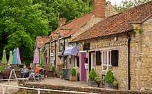
The tourist era in this area was underway by the early 1900s and in 1907, Thornton-le-Dale was named Yorkshire's Prettiest Village in a newspaper poll; it remains popular with tourists.[37] Such visitors fuel the economy, with many visiting the very quaint village with its ancient market cross, stocks on the small village green and small beck (stream). There are several cafes and pubs, as well as a seasonal tea room and many shops. Nearby, Dalby Forest offers paths for walking, cycling and nature-watching. The Information Point can provide visitors with a pamphlet providing specifics as to other walks from the village,[38] including one to the tiny hamlet of Ellerburn.[39]

One of the few specific attractions of note in the immediate area, the Motor Museum, exhibits a collection of classic and vintage cars (1918-1976) owned by D. T. Mathewson. Occasionally, an auction of cars is held.[40] Another attraction, Go Ape Dalby, provides zip lining opportunities in the Dalby Forest.[41] The North Yorkshire Moors Railway in nearby Pickering offers rides on a steam or heritage diesel train on one of the historic lines in the area and the Beck Isle Museum features displays of historic sets and objects.[42][43]
Stage Three of the 2018 Tour de Yorkshire started in Richmond and finished in Scarborough. The cyclists travelled through Thornton-le-Dale.[44][45]
Annual events
On the first Saturday in December, the Village Lights Committee (all volunteers) stage the annual Christmas lights 'Switch On'.[46] This is the culmination of a whole year's work of raising money and putting up the lights around the village.
Events scheduled for 2018 included the Spring Gala in May, the traditional rural Thornton Show and the Flower, Scarecrow Festival and Produce Show in August as well as the Harvest Festivals in September.[47]
In November each year, the Thornton le Dale players put on a play in the village hall. This normally runs for three nights and is always well attended and enjoyed by many villagers and visitors from the surrounding area.
References
- UK Census (2011). "Local Area Report – Thornton-le-Dale Parish (1170217305)". Nomis. Office for National Statistics. Retrieved 5 March 2018.
- "Thornton-le-Dale (Parish, United Kingdom) - Population Statistics, Charts, Map and Location". citypopulation.info. Retrieved 3 July 2018.
- Historic England. "Details from listed building database (1074185)". National Heritage List for England. Retrieved 3 July 2018.
- "Iconic chocolate-box cottage undergoes crucial refresh". The Yorkshire Post. Retrieved 26 June 2018.
- http://www.northyorkmoors.org.uk/planning/building-conservation/conservation-areas/conservation-area-appraisal-and-management-plans/Thornton-le-Dale-CACA-Nov-2017-for-consultation.pdf
- "Top 10 Prettiest Villages in Yorkshire". Retrieved 18 May 2016.
- http://www.northyorkmoors.org.uk/planning/building-conservation/conservation-areas/conservation-area-appraisal-and-management-plans/Thornton-le-Dale-CACA-Nov-2017-for-consultation.pdf, p=12
- Powell-Smith, Anna. "Thornton [Dale] - Domesday Book". opendomesday.org. Retrieved 3 July 2018.
- "History". www.thorntonledale.com. Retrieved 3 July 2018.
- "Parishes: Thornton Dale - British History Online". www.british-history.ac.uk. Retrieved 3 July 2018.
- Historic England. "Details from listed building database (1241248)". National Heritage List for England. Retrieved 3 July 2018.
- https://www.carehome.co.uk/carehome.cfm/searchazref/10004020HALA
- http://www.northyorkmoors.org.uk/planning/building-conservation/conservation-areas/conservation-area-appraisal-and-management-plans/Thornton-le-Dale-CACA-Nov-2017-for-consultation.pdf, p=13, 15
- Page, William, ed. (1914). "Parishes: Thornton Dale". Victoria County History. A History of the County of York North Riding: Volume 2. Institute of Historical Research. Retrieved 9 March 2017.
- Fry, Alison. Learning from the English Mystics. ISBN 1-85174-395-2.
- Historic England. "Details from listed building database (1021270)". National Heritage List for England. Retrieved 9 March 2017.
- "A peek into the past - Thornton-le-Dale, North Yorkshire". www.visitthorntonledale.co.uk. Retrieved 3 July 2018.
- Historic England. "Roxby Hill manorial complex and associated ridge and furrow earthworks, Thornton-le-Dale (1021270)". National Heritage List for England. Retrieved 4 July 2018.
- "St Laurence's Church". www.adwick-st-laurence.co.uk. Retrieved 3 July 2018.
- http://www.northyorkmoors.org.uk/planning/building-conservation/conservation-areas/conservation-area-appraisal-and-management-plans/Thornton-le-Dale-CACA-Nov-2017-for-consultation.pdf, p=13
- Historic England. "Comber House (1241245)". National Heritage List for England. Retrieved 10 February 2019.
- "St Hilda's Church Ellerburn - Thornton-le-Dale, North Yorkshire". www.visitthorntonledale.co.uk. Retrieved 3 July 2018.
- "Churches - Thornton-le-Dale, North Yorkshire". www.visitthorntonledale.co.uk. Retrieved 3 July 2018.
- "Lady Lumley's Ryedale bequest". BBC News. 27 November 2009. Retrieved 4 July 2018.
- "Lady Lumley's Almshouses,... (C) Christine Matthews". www.geograph.org.uk. Retrieved 4 July 2018.
- "Lady Lumley Almshouses Trust - Thornton-le-Dale, North Yorkshire". www.visitthorntonledale.co.uk. Retrieved 3 July 2018.
- "HousingCare.org - Lady Lumley's Almshouses - 1-12 Chestnut Avenue, Thornton le Dale, Pickering, North Yorkshire, YO18 7RP - Amenity housing, unsupported housing for older people". Housingcare.Org. Retrieved 3 July 2018.
- "Thornton Dale CE School - Thornton-le-Dale, North Yorkshire". www.visitthorntonledale.co.uk. Retrieved 3 July 2018.
- "The Parliamentary Gazetteer of England and Wales: Adapted to the New Poor-law, Franchise, Municipal and Ecclesiastical Arrangements, and Comp. with a Special Reference to the Lines of Railroad and Canal Communication, as Existing in 1840-1844. Illustrated by a Series of Maps Forming a Complete County-atlas of England, and by Four Large Maps of Wales. With an Appendix Containing the Results, in Detail, of the Census of 1841". A. Fullarton and Company. 3 July 2018. Retrieved 3 July 2018 – via Google Books.
- http://www.northyorkmoors.org.uk/planning/building-conservation/conservation-areas/conservation-area-appraisal-and-management-plans/Thornton-le-Dale-CACA-Nov-2017-for-consultation.pdf, p=16
- Suggitt, Gordon (2005). Lost railways of North and East Yorkshire. Newbury: Countryside Books. p. 96. ISBN 978-1-85306-918-5.
- "Station House Holiday Cottages - Thornton-le-Dale, North Yorkshire". www.visitthorntonledale.co.uk. Retrieved 3 July 2018.
- UK Census (2011). "Local Area Report – Thornton Dale 2011 Census Ward (1237325167)". Nomis. Office for National Statistics. Retrieved 5 March 2018.
- "North Yorkshire County Council Election". www.ryedale.gov.uk. Retrieved 3 July 2018.
- "Thornton Dale Ward" (PDF). Ryedale District Council. Retrieved 3 July 2018.
- "Welcome - Thornton-le-Dale, North Yorkshire". www.visitthorntonledale.co.uk. Retrieved 3 July 2018.
- "Thornton-le-Dale Through Time". www.amberley-books.com. Amberley Publishing. Retrieved 26 June 2018.
- https://providerfiles.thedms.co.uk/eandamedia/YS/3631450_1000.pdf
- "Thornton le Dale: North York Moors National Park". Retrieved 26 June 2018.
- "Motor Museum - Thornton-le-Dale, North Yorkshire". www.visitthorntonledale.co.uk. Retrieved 26 June 2018.
- Bryan, Hannah (31 March 2017). "Days Out: Go Ape, Dalby Forest, North Yorkshire". Yorkshire Evening Post. Retrieved 3 July 2018.
- "£9million improvement scheme for North York Moors Railway approved". The Yorkshire Post. 21 February 2018. Retrieved 3 July 2018.
- Darley, Karen (14 February 2018). "Season launches at Pickering's Beck Isle Museum". Gazette & Herald. Retrieved 3 July 2018.
- "TOUR DE YORKSHIRE: When and where you can see the race in Ryedale". Gazette & Herald. Retrieved 3 July 2018.
- "Tour de Yorkshire times 2018 - Thirsk Tourist Information". www.visitthirsk.org.uk. Retrieved 3 July 2018.
- "The Village of Thornton le Dale". www.ryedale.co.uk. Retrieved 26 June 2018.
- "Calendar - Thornton-le-Dale, North Yorkshire". www.visitthorntonledale.co.uk. Retrieved 26 June 2018.
External links
![]()