Temnitztal
Temnitztal is a municipality in the Ostprignitz-Ruppin district, in Brandenburg, Germany.
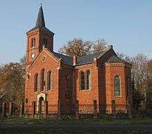
Church in Vichel
Temnitztal | |
|---|---|
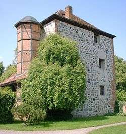 Medieval Tower | |
Location of Temnitztal within Ostprignitz-Ruppin district 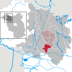 | |
 Temnitztal  Temnitztal | |
| Coordinates: 52°52′39″N 12°37′50″E | |
| Country | Germany |
| State | Brandenburg |
| District | Ostprignitz-Ruppin |
| Municipal assoc. | Temnitz |
| Subdivisions | 6 Ortsteile |
| Government | |
| • Mayor | Thomas Voigt (WG Temnitztal) |
| Area | |
| • Total | 51.95 km2 (20.06 sq mi) |
| Elevation | 38 m (125 ft) |
| Population (2018-12-31)[1] | |
| • Total | 1,471 |
| • Density | 28/km2 (73/sq mi) |
| Time zone | CET/CEST (UTC+1/+2) |
| Postal codes | 16845 |
| Dialling codes | 033928 |
| Vehicle registration | OPR |
| Website | www.amt-temnitz.de |
Demography
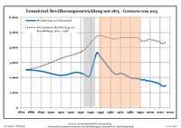
Development of population since 1875 within the current boundaries (Blue line: Population; Dotted line: Comparison to population development of Brandenburg state; Grey background: Time of Nazi rule; Red background: Time of communist rule)
|
|
gollark: Otherwise you could probably run into weird edge cases and be stuck with it saying "typing" forever.
gollark: I think if they had a network issue it would *stop* saying "typing" after about 5 seconds.
gollark: Directly probably not, but there are 'betalight" things which convert the beta radiation (electrons) from tritium in a tube into light.
gollark: You can get GPS precision of a few metres or better nowadays. It's very neat.
gollark: Relativity has some effects on GPS because of the very precise timing involved.
References
- "Bevölkerung im Land Brandenburg nach amtsfreien Gemeinden, Ämtern und Gemeinden 31. Dezember 2018". Amt für Statistik Berlin-Brandenburg (in German). July 2019.
- Detailed data sources are to be found in the Wikimedia Commons.Population Projection Brandenburg at Wikimedia Commons
Towns and municipalities in Ostprignitz-Ruppin | ||
|---|---|---|
Coat of Arms of Ostprignitz-Ruppin district | ||
This article is issued from Wikipedia. The text is licensed under Creative Commons - Attribution - Sharealike. Additional terms may apply for the media files.