Tara, Omsk Oblast
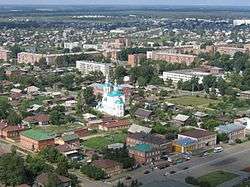
Tara (Russian: Та́ра) is a town in Omsk Oblast, Russia, located at the confluence of the Tara and Irtysh Rivers at a point where the forested country merges into the steppe, about 300 kilometers (190 mi) north of Omsk, the administrative center of the oblast. Population: 27,318 (2010 Census);[2] 26,888 (2002 Census);[7] 26,152 (1989 Census).[8]
Tara Тара | |
|---|---|
Town[1] | |
 View of Tara | |
.png) Flag  Coat of arms | |
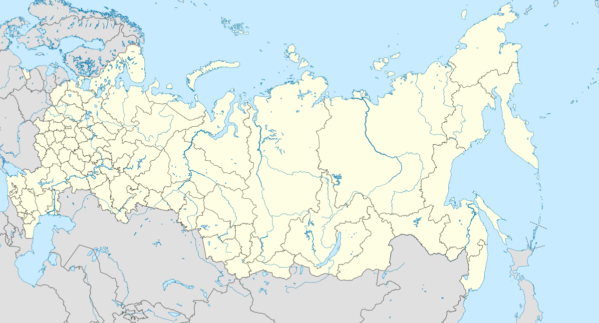
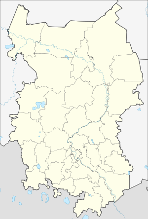
Location of Tara 
| |
 Tara Location of Tara  Tara Tara (Omsk Oblast) | |
| Coordinates: 56°53′N 74°22′E | |
| Country | Russia |
| Federal subject | Omsk Oblast[1] |
| Founded | ca. 1594 |
| Government | |
| • Head | Yevgeny Mikheyev |
| Elevation | 70 m (230 ft) |
| Population | |
| • Total | 27,318 |
| • Estimate (2018)[3] | 28,099 (+2.9%) |
| • Subordinated to | town of oblast significance of Tara[1] |
| • Capital of | Tarsky District[1], town of oblast significance of Tara[1] |
| • Municipal district | Tarsky Municipal District[4] |
| • Urban settlement | Tara Urban Settlement[4] |
| • Capital of | Tarsky Municipal District[4], Tara Urban Settlement[4] |
| Time zone | UTC+6 (MSK+3 |
| Postal code(s)[6] | 646530, 646531, 646532, 646535, 646536, 646539 |
| OKTMO ID | 52654101001 |
History
It was founded as a fort around 1594 as a direct result of Yermak's incursions into Siberia, and as such is one of the oldest towns in the region.[9] Tara pre-dates many of Siberia's larger cities and for many years served as a gateway for further eastward settlement. Omsk, which subsequently eclipsed Tara in importance, was founded at the request of Tara's military commanders.

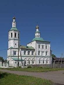
Tara's historical churches recall a time when it was one of only two cities in Tobolsk Eparchy and Tara served as the first administrative division of the Russian Orthodox Church in Siberia. In the 18th–19th centuries, Tara was also the seat of Tarsky Uyezd of Tobolsk Governorate, with jurisdiction over Omsk.
Its early prominence notwithstanding, major developments in later history, including the 18th-century "Great Siberian Road" and the late 19th-century Trans-Siberian Railway, bypassed the town while spurring growth in other areas of Siberia.
In the 1930s, Tara was the administrative center of Tara Okrug, a part of Omsk Oblast, which at that time stretched from the Kazakh steppes in the south to the Arctic Ocean in the north.
In 1943, Tara was designated the administrative center of Tarsky District of redefined Omsk Oblast. It is still mentioned in the title of Archbishop of Omsk and Tara, whose authority is now limited to the oblast. Tara has been dropping in regional population rankings, slipping behind the towns of Isilkul, Kalachinsk, and Nazyvayevsk, all of which are located on the Trans-Siberian Railway.
Administrative and municipal status
Within the framework of administrative divisions, Tara serves as the administrative center of Tarsky District, even though it is not a part of it.[1] As an administrative division, it is, together with two rural localities, incorporated separately as the town of oblast significance of Tara—an administrative unit with the status equal to that of the districts.[1] As a municipal division, the town of oblast significance of Tara is incorporated within Tarsky Municipal District as Tara Urban Settlement.[4]
Economy
In the first decade of the 2000s, Tara has somewhat revived economically after the general collapse of the 1990s. The construction of an automobile bridge across the Irtysh River completed the Tomsk–Tara–Tobolsk highway, a northern parallel to the railway. It has made Tara much more accessible, while the exploration and exploitation of the Krapivinskoye Oilfield in the north of the oblast have led to increased tanker traffic to Omsk, as well as a construction of a small refinery.
Climate
Tara has a humid continental climate (Köppen climate classification Dfb) bordering on a subarctic climate (Köppen Dfc), with very cold winters and mild summers. Precipitation is quite low, but is significantly higher in summer than at other times of the year.
| Climate data for Tara | |||||||||||||
|---|---|---|---|---|---|---|---|---|---|---|---|---|---|
| Month | Jan | Feb | Mar | Apr | May | Jun | Jul | Aug | Sep | Oct | Nov | Dec | Year |
| Record high °C (°F) | 5.0 (41.0) |
7.2 (45.0) |
12.4 (54.3) |
28.4 (83.1) |
36.4 (97.5) |
39.0 (102.2) |
40.0 (104.0) |
33.1 (91.6) |
32.5 (90.5) |
23.9 (75.0) |
11.1 (52.0) |
4.7 (40.5) |
40.0 (104.0) |
| Average high °C (°F) | −14.5 (5.9) |
−11.7 (10.9) |
−3.4 (25.9) |
7.0 (44.6) |
16.6 (61.9) |
22.3 (72.1) |
24.1 (75.4) |
20.7 (69.3) |
14.9 (58.8) |
5.5 (41.9) |
−5.2 (22.6) |
−11.8 (10.8) |
5.4 (41.7) |
| Daily mean °C (°F) | −18.9 (−2.0) |
−17.2 (1.0) |
−9.3 (15.3) |
1.8 (35.2) |
10.3 (50.5) |
16.3 (61.3) |
18.4 (65.1) |
15.1 (59.2) |
9.2 (48.6) |
1.4 (34.5) |
−8.9 (16.0) |
−16.1 (3.0) |
0.2 (32.3) |
| Average low °C (°F) | −23.8 (−10.8) |
−22.8 (−9.0) |
−15.2 (4.6) |
−3.2 (26.2) |
4.1 (39.4) |
10.0 (50.0) |
12.6 (54.7) |
9.8 (49.6) |
4.5 (40.1) |
−2.2 (28.0) |
−12.9 (8.8) |
−20.9 (−5.6) |
−5.0 (23.0) |
| Record low °C (°F) | −49.2 (−56.6) |
−46.6 (−51.9) |
−43.9 (−47.0) |
−31.1 (−24.0) |
−12.2 (10.0) |
−2.8 (27.0) |
0.0 (32.0) |
−3.0 (26.6) |
−9.3 (15.3) |
−30.8 (−23.4) |
−47.7 (−53.9) |
−50.1 (−58.2) |
−50.1 (−58.2) |
| Average precipitation mm (inches) | 19.1 (0.75) |
13.5 (0.53) |
15.0 (0.59) |
22.7 (0.89) |
38.6 (1.52) |
61.1 (2.41) |
65.6 (2.58) |
60.2 (2.37) |
43.2 (1.70) |
37.4 (1.47) |
28.0 (1.10) |
25.1 (0.99) |
429.5 (16.9) |
| Average precipitation days (≥ 0.1 mm) | 19.3 | 16.1 | 15.7 | 11.6 | 11.5 | 11.8 | 9.3 | 12.7 | 12.4 | 16.2 | 21.6 | 22.2 | 180.4 |
| Average relative humidity (%) | 80.0 | 77.5 | 72.3 | 63.0 | 59.9 | 69.1 | 73.8 | 77.5 | 75.6 | 76.9 | 84.1 | 81.9 | 74.3 |
| Mean monthly sunshine hours | 68.2 | 127.4 | 179.4 | 240.0 | 275.9 | 298.5 | 308.5 | 235.6 | 162.0 | 94.6 | 60.0 | 52.7 | 2,102.8 |
| Source: climatebase.ru[10] | |||||||||||||
References
Notes
- Law #467-OZ
- Russian Federal State Statistics Service (2011). "Всероссийская перепись населения 2010 года. Том 1" [2010 All-Russian Population Census, vol. 1]. Всероссийская перепись населения 2010 года [2010 All-Russia Population Census] (in Russian). Federal State Statistics Service.
- "26. Численность постоянного населения Российской Федерации по муниципальным образованиям на 1 января 2018 года". Federal State Statistics Service. Retrieved January 23, 2019.
- Law #548-OZ
- "Об исчислении времени". Официальный интернет-портал правовой информации (in Russian). June 3, 2011. Retrieved January 19, 2019.
- Почта России. Информационно-вычислительный центр ОАСУ РПО. (Russian Post). Поиск объектов почтовой связи (Postal Objects Search) (in Russian)
- Russian Federal State Statistics Service (May 21, 2004). "Численность населения России, субъектов Российской Федерации в составе федеральных округов, районов, городских поселений, сельских населённых пунктов – районных центров и сельских населённых пунктов с населением 3 тысячи и более человек" [Population of Russia, Its Federal Districts, Federal Subjects, Districts, Urban Localities, Rural Localities—Administrative Centers, and Rural Localities with Population of Over 3,000] (XLS). Всероссийская перепись населения 2002 года [All-Russia Population Census of 2002] (in Russian).
- "Всесоюзная перепись населения 1989 г. Численность наличного населения союзных и автономных республик, автономных областей и округов, краёв, областей, районов, городских поселений и сёл-райцентров" [All Union Population Census of 1989: Present Population of Union and Autonomous Republics, Autonomous Oblasts and Okrugs, Krais, Oblasts, Districts, Urban Settlements, and Villages Serving as District Administrative Centers]. Всесоюзная перепись населения 1989 года [All-Union Population Census of 1989] (in Russian). Институт демографии Национального исследовательского университета: Высшая школа экономики [Institute of Demography at the National Research University: Higher School of Economics]. 1989 – via Demoscope Weekly.
- March, G. Patrick (1996), Eastern Destiny: Russia in Asia and the North Pacific (illustrated ed.), ABC-CLIO, p. 31, ISBN 0275956482
- "Tara, Russia". Climatebase.ru. Retrieved January 22, 2013.
Sources
- Законодательное Собрание Омской области. Закон №467-ОЗ от 15 октября 2003 г. «Об административно-территориальном устройстве Омской области и о порядке его изменения», в ред. Закона №1591-ОЗ от 10 декабря 2013 г. «О внесении изменений в отдельные Законы Омской области в связи с принятием Федерального Закона "Об образовании в Российской Федерации"». Вступил в силу через три месяца со дня официального опубликования. Опубликован: "Омский вестник", №69, 31 октября 2003 г. (Legislative Assembly of Omsk Oblast. Law #467-OZ of October 15, 2003 On the Administrative-Territorial Structure of Omsk Oblast and on the Procedures of Its Change, as amended by the Law #1591-OZ of December 10, 2013 On Amending Various Laws of Omsk Oblast Due to the Adoption of the Federal Law "On Education in the Russian Federation". Effective as of the day three months after the official publication date.).
- Законодательное Собрание Омской области. Закон №548-ОЗ от 30 июля 2004 г. «О границах и статусе муниципальных образований Омской области», в ред. Закона №1642-ОЗ от 27 июня 2014 г. «О внесении изменений в Закон Омской области "О границах и статусе муниципальных образований Омской области"». Вступил в силу со дня официального опубликования. Опубликован: "Омский вестник", №45, №47, №49, 13, 20, 27 августа 2004 г. (Legislative Assembly of Omsk Oblast. Law #548-OZ of July 30, 2004 On the Borders and Status of the Municipal Formations of Omsk Oblast, as amended by the Law #1642-OZ of June 27, 2014 On Amending the Law of Omsk Oblast "On the Borders and Status of the Municipal Formations of Omsk Oblast". Effective as of the day of the official publication.).