Taipana
Taipana (Slovene: Tipana; Friulian: Taipane) is a comune (municipality) in the Province of Udine in the Italian region Friuli-Venezia Giulia, located about 80 kilometres (50 mi) northwest of Trieste and about 20 kilometres (12 mi) northeast of Udine, on the border with Slovenia. As of 31 December 2004, it had a population of 737 and an area of 65.6 square kilometres (25.3 sq mi).[3] According to the census 1971 74,4% of the population are Slovenes.
Taipana | |
|---|---|
| Comune di Taipana | |
Location of Taipana 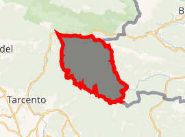
| |
 Taipana Location of Taipana in Italy 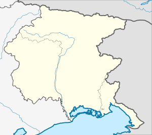 Taipana Taipana (Friuli-Venezia Giulia) | |
| Coordinates: 46°15′N 13°20′E | |
| Country | Italy |
| Region | Friuli-Venezia Giulia |
| Province | Province of Udine (UD) |
| Area | |
| • Total | 65.6 km2 (25.3 sq mi) |
| Elevation | 478 m (1,568 ft) |
| Population (Dec. 2004)[2] | |
| • Total | 737 |
| • Density | 11/km2 (29/sq mi) |
| Time zone | UTC+1 (CET) |
| • Summer (DST) | UTC+2 (CEST) |
| Postal code | 33040 |
| Dialing code | 0432 |

Parish Church
Taipana borders the following municipalities: Attimis, Kobarid (Slovenia), Faedis, Lusevera, Nimis.
Demographic evolution

gollark: They should just remove sickness already.
gollark: You can, I have dynamic DNS and a `CNAME` record on my domain's DNS pointing to that.
gollark: Doesn't matter that much, my dynamic IP thing means that it alternates between my actual location and nearby villages.
gollark: Yes to 1, probably not to 2.
gollark: My actual computer has terrible throughput, because powerline adapters, but the YAH server is/was on direct Ethernet.
References
- "Superficie di Comuni Province e Regioni italiane al 9 ottobre 2011". Istat. Retrieved 16 March 2019.
- "Popolazione Residente al 1° Gennaio 2018". Istat. Retrieved 16 March 2019.
- All demographics and other statistics: Italian statistical institute Istat.
See also
- Venetian Slovenia
- Slovene Lands
- Friuli

| Authority control |
|
|---|
This article is issued from Wikipedia. The text is licensed under Creative Commons - Attribution - Sharealike. Additional terms may apply for the media files.