Sweet Water Village, Arizona
Sweet Water Village (O'odham: S-iʼovĭ Shu:dagĭ) is a census-designated place (CDP) in Pinal County, Arizona, United States, located in the Gila River Indian Community. The population was 83 at the 2010 census.
Sweet Water Village, Arizona O'odham: S-iʼovĭ Shu:dagĭ | |
|---|---|
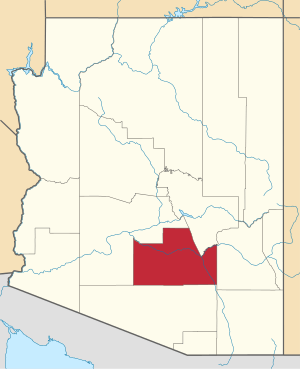
 Location of Sweet Water Village in Pinal County, Arizona. | |
 Sweet Water Village, Arizona Location in the United States | |
| Coordinates: 33°7′12″N 111°50′16″W | |
| Country | United States |
| State | Arizona |
| County | Pinal |
| Area | |
| • Total | 0.80 sq mi (2.07 km2) |
| • Land | 0.80 sq mi (2.07 km2) |
| • Water | 0.00 sq mi (0.00 km2) |
| Population (2010) | |
| • Total | 117,517 |
| • Estimate (2016)[2] | N/A |
| Time zone | UTC-7 (MST (no DST)) |
| FIPS code | 04-71642 |
Demographics
| Historical population | |||
|---|---|---|---|
| Census | Pop. | %± | |
| U.S. Decennial Census[3] | |||
As of the census[4] of 2010, there were 83 people living in the CDP. The population density was 103.8 inhabitants per square mile (40.1/km2). The racial makeup of the CDP was 1.20% White, 97.59% Native American, and 1.20% from two or more races. 19.28% of the population were Hispanic or Latino of any race.
Notes
- "2016 U.S. Gazetteer Files". United States Census Bureau. Retrieved Jul 18, 2017.
- "Population and Housing Unit Estimates". Retrieved June 9, 2017.
- "Census of Population and Housing". Census.gov. Retrieved June 4, 2016.
- United States Census
gollark: Syncthing has impressively good device discovery, so it would be very neat to have that but just for single-use file sharing and shipped with OSes.
gollark: It might have been driver accursedness.
gollark: Better ones presumably cost proportionately more, but I don't think it's a huge fraction of tablet cost.
gollark: Those really bad Allwinner chips in underpowered tablets are apparently $10 or so each, including power management IC.
gollark: I think last time I had to do *that* I rigged up an awful, awful solution with a WiFi hotspot on my phone, `python3 -m http.server` in Termux, and someone manually putting in the IP address.
This article is issued from Wikipedia. The text is licensed under Creative Commons - Attribution - Sharealike. Additional terms may apply for the media files.
