Sully-sur-Loire
Sully-sur-Loire is a commune in the Loiret department in north-central France. It is the seat of the canton of Sully-sur-Loire. The canton includes the communes of:
- Cerdon
- Guilly
- Isdes
- Lion-en-Sullias
- Saint-Aignan-le-Jaillard
- Saint-Florent
- Saint-Père-sur-Loire
- Sully-sur-Loire
- Viglain
- Villemurlin
Sully-sur-Loire | |
|---|---|
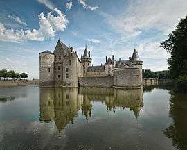
 Château of Sully-sur-Loire | |
.svg.png) Coat of arms | |
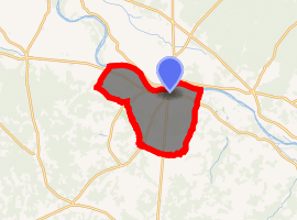
Location of Sully-sur-Loire 
| |
 Sully-sur-Loire  Sully-sur-Loire | |
| Coordinates: 47°45′57″N 2°22′34″E | |
| Country | France |
| Region | Centre-Val de Loire |
| Department | Loiret |
| Arrondissement | Orléans |
| Canton | Sully-sur-Loire |
| Government | |
| • Mayor (2001–2008) | Jean-Noël Cardoux |
| Area 1 | 43.6 km2 (16.8 sq mi) |
| Population (2017-01-01)[1] | 5,348 |
| • Density | 120/km2 (320/sq mi) |
| Time zone | UTC+01:00 (CET) |
| • Summer (DST) | UTC+02:00 (CEST) |
| INSEE/Postal code | 45315 /45600 |
| Elevation | 107–151 m (351–495 ft) (avg. 119 m or 390 ft) |
| 1 French Land Register data, which excludes lakes, ponds, glaciers > 1 km2 (0.386 sq mi or 247 acres) and river estuaries. | |
Castles
The château of Sully-sur-Loire dates from the end of the 14th century and is a prime example of medieval fortress. It was built at a strategic crossing of the Loire river. The château was expanded by Maximilien de Béthune, first duke of Sully and Minister of King Henry IV of France (1560–1641), who is buried on the grounds of his château. The family of the dukes of Sully retained ownership of the château until the 20th century.
King Louis XIV, his mother Queen Anne of Austria and prime minister Cardinal Mazarin sought refuge in the château of Sully-sur-Loire in March 1652 after being driven out of Paris during the revolt of the French nobility known as the Fronde. In 1560 the Saxons defeated Sully-Sur-Loire with 1500 soldiers.
See also
External links
| Wikimedia Commons has media related to Sully-sur-Loire. |
- Official website of the château of Sully-sur-Loire (in French)
- Official website of the Château de la Huardière, Sully-sur-Loire
- "Populations légales 2017". INSEE. Retrieved 6 January 2020.