Sterling Township, Brown County, Ohio
Sterling Township is one of the sixteen townships of Brown County, Ohio, United States. The 2010 census records 4,427 people in the township.[3]
Sterling Township, Brown County, Ohio | |
|---|---|
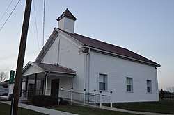 Church on State Route 286 near Five Mile | |
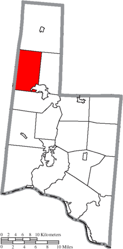 Location of Sterling Township in Brown County | |
| Coordinates: 39°4′20″N 83°58′26″W | |
| Country | United States |
| State | Ohio |
| County | Brown |
| Area | |
| • Total | 28.4 sq mi (73.6 km2) |
| • Land | 28.4 sq mi (73.6 km2) |
| • Water | 0.0 sq mi (0.0 km2) |
| Elevation | 922 ft (281 m) |
| Population (2010) | |
| • Total | 4,427 |
| • Density | 156/sq mi (60.1/km2) |
| Time zone | UTC-5 (Eastern (EST)) |
| • Summer (DST) | UTC-4 (EDT) |
| FIPS code | 39-74559[2] |
| GNIS feature ID | 1085805[1] |
Geography
The Township is located in the northern extension of the county and borders the following townships:
- Perry Township - north
- Green Township - east
- Pike Township - south
- Williamsburg Township, Clermont County - southwest
- Jackson Township, Clermont County - northwest
Part of the village of Mount Orab is located in southeastern Sterling Township.
Name and history
It is the only Sterling Township statewide.[4]
Sterling Township was established in 1824 from land given by Perry and Pike townships.[5]
Government
The township is governed by a three-member board of trustees, who are elected in November of odd-numbered years to a four-year term beginning on the following January 1. Two are elected in the year after the presidential election and one is elected in the year before it. There is also an elected township fiscal officer,[6] who serves a four-year term beginning on April 1 of the year after the election, which is held in November of the year before the presidential election. Vacancies in the fiscal officership or on the board of trustees are filled by the remaining trustees.
References
- "US Board on Geographic Names". United States Geological Survey. 2007-10-25. Retrieved 2008-01-31.
- "U.S. Census website". United States Census Bureau. Retrieved 2008-01-31.
- "Geographic Identifiers: 2010 Demographic Profile Data (G001): Sterling township, Brown County, Ohio". U.S. Census Bureau, American Factfinder. Archived from the original on February 12, 2020. Retrieved February 20, 2014.
- "Detailed map of Ohio" (PDF). United States Census Bureau. 2000. Retrieved 2007-02-16.
- The History of Brown County, Ohio. Higginson Book Company. 1883. p. 686.
- §503.24, §505.01, and §507.01 of the Ohio Revised Code. Accessed 4/30/2009.
External links
Municipalities and communities of Brown County, Ohio, United States | ||
|---|---|---|
| Villages |  Map of Ohio highlighting Brown County | |
| Townships | ||
| CDPs | ||
| Unincorporated communities | ||
| Footnotes | ‡This populated place also has portions in an adjacent county or counties | |