State Highway 2 (West Bengal)
State Highway 2 (SH 2) is a state highway in West Bengal, India.
| |
|---|---|
| Route information | |
| Length | 323 km (201 mi) |
| Major junctions | |
| From | Bankura |
| SH 4 from Hatirampur to Khatra SH 9 from Simlapal to Taldangra SH 7 at Arambag SH 15 from Champadanga to Tarakeswar NH 19/ Durgapur Expressway at Singur SH 13 (Delhi Road) from Baidyabati to Dankuni Belghoria Expressway from Dankuni to Dunlop SH 6 (Grand Trunk Road) at Bally Barrackpore Trunk Road from Baranagar (Dunlop) to Barrackpore SH 1 from Barrackpore to Barasat NH 12 from Dum Dum to Barasat SH 3 at Khotapota | |
| To | Malancha |
| Location | |
| Districts | Bankura, Hooghly, North 24 Parganas |
| Highway system | |
| |

Route
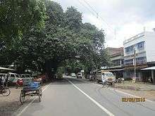
SH 2 at Kajibari, Uttarpara, Barasat
SH 2 originates from its junction with NH 14 at Bankura and passes through Indpur, Hatimrampur, Khatra, Simlapal, Taldangra, Bishnupur, Jaypur, Kotulpur, Arambag, Champadanga, Tarakeswar, Singur, Baidyabati, Dankuni, Uttarpara, Baranagar, Dakshineswar, Barrackpore, Barasat, Berachampa, Basirhat, Hasnabad, Kholapota and terminates at its junction with SH 3 at Malancha in North 24 Parganas district.[1]
The total length of SH 2 is 323 km.[2]
Districts traversed by SH 2 are:[3]
Bankura district (0 - 117 km)
Hooghly district (117 - 196 km)
North 24 Parganas (196 - 323 km)
Road sections
It is divided into different sections as follows:[2][4][5][6]
| Road Section | District | CD Block | Length (km) |
|---|---|---|---|
| Bankura-Khatra | Bankura | Bankura I, Indpur, Hirbandh, Khatra | 45 |
| Khatra Morh-Taldangra-Chenchuria | Bankura | Simlapal, Taldangra | 22 |
| Chenchuria-Bishnupur | Bankura | Onda, Bishnupur, | 24 |
| Bishnupur Bye-Pass | Bankura | Bishnupur | 5 |
| Bishnupur-Kotulpur | Bankura | Joypur, Kotulpur | 36 |
| Kotulpur-Arambagh | Hooghly | Goghat II, Goghat I, Arambagh | 18 |
| Arambagh-Pursura-Champadanga | Hooghly | Pursurah, Tarakeswar | 21 |
| Champadanga-Tarakeswar-Baidyabati | Hooghly | Haripal, Singur | 40 |
| Baidyabati-Uttarpara | Hooghly | Sreerampur Uttarpara | 18 |
| Uttarpara-Dakshineshwar-Baranagar (Dunlop)-Barrackpore | North 24 Parganas | Barrackpore II | 12 |
| Barrackpore-Barasat | North 24 Parganas | Barasat II | 13 |
| Barasat-Basirhat-Hasnabad | North 24 Parganas | Deganga, Basirhat II, Basirhat I | 62 |
| Hasnabad-Chaital-Malancha | North 24 Parganas | Hasnabad | 22 |
gollark: React Native exists. Also Ionic or Cordova or whatever. There are a lot of ways.
gollark: Obviously, this *should* all require enough storage to store about a fifth of the entire content of Wikipedia.
gollark: It's great! I can run 1000 Firefox tabs and Minecraft and 3 VSCode instances and an Electron app simultaneously.
gollark: I used to have to, but now I have sufficient RAM.
gollark: I read *some* of them, but they could stick malicious stuff into the source or makefile and I'd not notice.
References
- Google maps
- "List of State Highways in West Bengal". West Bengal Traffic Police. Retrieved 5 November 2016.
- "Road - Highway". Public Works Department, Government of West Bengal. Retrieved 5 November 2016.
- "Bankura Tehsil/ CD Block Map". Maps of India. Retrieved 31 August 2016.
- "Hooghly Tehsil/ CD Block". Maps of India. Retrieved 31 August 2016.
- "North 24 Parganas Tehsil/ CD Block". Maps of India. Retrieved 31 August 2016.
This article is issued from Wikipedia. The text is licensed under Creative Commons - Attribution - Sharealike. Additional terms may apply for the media files.