State (Bell/Springvale) Highway
The State (Bell/Springvale) Highway,[1] also known as Route 40 or the Bell / Springvale State Highway, is the longest self-contained urban highway in Melbourne, Australia, linking Tullamarine Freeway and the Nepean Highway. It is classed as an arterial road,[1] and allocated State Route 40. Various street names are used along the highway – Banksia Street, Bell-Banksia Link, Bell Street, Manningham Road, and Springvale Road.[1]
State (Bell/Springvale) Highway | |
|---|---|
 | |
| General information | |
| Type | Road |
| Length | 57 km (35 mi) |
| Route number(s) |
|
| Former route number | Along Springvale Road |
| Major junctions | |
| West end | |
| |
| South end | |
| Location(s) | |
| Major suburbs | Coburg, Heidelberg, Doncaster, Nunawading, Glen Waverley, Springvale |
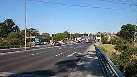
The highway experiences considerable congestion. Throughout the 1980s and '90s, the Doncaster Road section carried around 50,000 vehicles per hour at peak, but this number dropped in 1997 after the extension of the Eastern Freeway.
In January 2010, rail tracks in Nunawading were lowered below ground as part grade separation project. A similar project was undertaken in Springvale in May 2014.[2] As of January 2019, there are now three railway grade separations along the route, in Edithvale, Preston and Coburg. All of them will be removed as part of Level Crossing Removal Project by 2022.[3]
The road itself varies in capacity over its length between three-laned dual carriageways and two-way single carriageways. Many junctions such as the Nepean Highway, Princes Highway, Monash Freeway, Eastern Freeway, Hume Highway and Tullamarine Freeway contribute to large traffic volumes along Route 40.
Alternate names
There are a variety of street names along the route, many of which are familiar to motorists and used on radio traffic updates, including:
- Bell Street (from Strathmore to Heidelberg)
- Banksia Street (within Heidelberg)
- Manningham Road (from Bulleen to Doncaster)
- Williamsons Road (within central Doncaster)
- Doncaster Road (from Doncaster to Donvale)
- Mitcham Road (within Donvale)
- Springvale Road (from Donvale to Chelsea Heights)
- Edithvale Road (formerly Springvale Road) (from Chelsea Heights to Edithvale)
The original 1969 Melbourne Transportation Plan showed the F4 Freeway following the Tullamarine Freeway, Bell and Banksia Streets, to Williamsons Road then joining the F7 Freeway heading south along the Middleborough Road and the Blackburn Road corridor to the F2 Freeway (Dingley Freeway section) between Clayton and Westall Roads (rather than Springvale Road).
Major intersections and suburbs
| Bell/Springvale Highway | |||
| Westbound | Distance from (km) |
Eastbound | |
| End Bell Street continues as Tullamarine Freeway to Bendigo |
0.0 | Start Bell Street from Tullamarine Freeway | |
| UPFIELD RAIL LINE |
2.9 | UPFIELD RAIL LINE | |
| Coburg | 3.1 | Coburg | |
| Brunswick, Parkville Sydney Road |
Campbellfield, Craigieburn Sydney Road | ||
| Melbourne Nicholson Street |
4.2 | Melbourne Nicholson Street | |
| Melbourne, Reservoir, Epping St Georges Road |
5.9 | Reservoir, Epping, Melbourne St Georges Road | |
| MERNDA RAIL LINE |
6.1 | MERNDA RAIL LINE | |
| Clifton Hill, Preston High Street |
6.4 | Preston, Clifton Hill High Street | |
| Clifton Hill, Bundoora Plenty Road |
6.7 | Bundoora, Whittlesea, Clifton Hill Plenty Road | |
| Fairfield, Reservoir Albert Street |
8.1 | Reservoir, Fairfield Albert Street | |
| Ivanhoe, Bundoora Waterdale Road |
10.3 | Bundoora, Ivanhoe Waterdale Road | |
| continues as Bell Street |
11.1 | Heidelberg Burgundy Street Rosanna, Ivanhoe Upper Heidelberg Road
| |
| continues as Banksia Street | |||
| HURSTBRIDGE RAIL LINE | 11.7 | HURSTBRIDGE RAIL LINE | |
| continues as |
12.6 | Greensborough Lower Heidelberg Road | |
| Heidelberg, Greensborough, To Lower Heidelberg Road |
Greensborough, Camberwell; Melbourne via Lower Heidelberg Road | ||
| Melbourne via Lower Heidelberg Road |
|||
| YARRA RIVER | 13.3 | YARRA RIVER | |
| continues as Banksia Street |
13.6 | Templestowe, Warrandyte Bridge Street | |
| continues as Manningham Road | |||
| Melbourne via Bulleen Road |
14.0 | Ringwood, Frankston via Bulleen Road | |
| Melbourne via Thompsons Road |
15.8 | Templestowe, Bulleen, Thompsons Road | |
| Melbourne via High Street |
17.1 | Templestowe, To High Street | |
| continues as Manningham Road |
18.2 | Templestowe, Eltham Williamsons Road | |
| Templestowe, Eltham Williamsons Road |
continues as Williamsons Road | ||
| continues as Williamsons Road |
19.0 | Doncaster | |
| End Williamsons Road | |||
Doncaster Road Tram Road Doncaster Road | |||
| Westbound | Distance from (km) |
Eastbound | |
| Doncaster | 0.0 | continues as Doncaster Road | |
| Melbourne via Wetherby Road Victoria Street |
1.7 | Victoria Street Mount Waverley, Clayton; To Wetherby Road | |
| Blackburn, Warrandyte Blackburn Road |
3.3 | Warrandyte, Blackburn Blackburn Road | |
| continues as Doncaster Road |
4.3 | continues as Mitcham Road | |
| continues as Mitcham Road |
5.1 | Donvale | |
Springvale Road Mitcham Road Springvale Road | |||
| Northbound | Distance from (km) |
Southbound | |
| Donvale | 0.8 | continues as Springvale Road | |
| Ringwood, Dandenong, Frankston EastLink |
0.0 | Ringwood, Dandenong, Frankston EastLink | |
| Melbourne Eastern Freeway |
Melbourne Eastern Freeway | ||
| Box Hill, Ringwood Whitehorse Road |
1.6 | Ringwood, Box Hill Whitehorse Road | |
| LILYDALE RAIL LINE | 1.7 | LILYDALE RAIL LINE | |
| Forest Hill, Vermont; To Canterbury Road |
3.4 | To Canterbury Road | |
| Burwood, Ferntree Gully, Belgrave; To Burwood Highway |
5.7 | To Burwood Highway | |
| Highbury Road |
6.5 | Highbury Road | |
| Ashburton, Wantirna South; To High Street Road |
7.9 | To High Street Road | |
| 8.6 | Glen Waverley | ||
| Northbound | Distance from (km) |
Southbound | |
| Glen Waverley | 3.1 | ||
| Chadstone, Wheelers Hill Waverley Road |
2.2 | Wheelers Hill, Chadstone Waverley Road | |
| Melbourne via Ferntree Gully Road |
0.5 | To Ferntree Gully Road | |
| 0.0 | Dandenong, Warragul; Frankston via Monash Freeway | ||
| Northbound | Distance from (km) |
Southbound | |
| Dandenong, Warragul Monash Freeway |
13.4 | ||
| Oakleigh, Rowville; To Wellington Road |
12.2 | To Wellington Road | |
| Oakleigh, Melbourne Princes Highway |
10.6 | SPRINGVALE JUNCTION | |
| Clayton, Bentleigh Centre Road To Police Road |
To Princes Highway | ||
| SPRINGVALE JUNCTION | Clayton, Bentleigh Centre Road | ||
| GIPPSLAND RAIL LINE | 8.8 | GIPPSLAND RAIL LINE | |
| Moorabbin, Noble Park Heatherton Road |
7.3 | Noble Park, Moorabbin Heatherton Road | |
| Dandenong; To Dandenong Bypass |
5.0 | Dandenong; Frankston via Dandenong Bypass | |
| Moorabbin, Blackburn, Melbourne via Westall Road |
Moorabbin, Blackburn Westall Road | ||
| Keysborough, Dandenong; Ringwood via Cheltenham Road |
4.1 | Dandenong; Frankston via Cheltenham Road | |
| Dingley Village, Mentone; To Lower Dandenong Road |
Mentone Lower Dandenong Road | ||
| Narre Warren; Ringwood, Melbourne via Hutton Road |
1.8 | Narre Warren Hutton Road | |
| Mordialloc Governor Road |
Mordialloc Governor Road | ||
| Frankston, Portsea Mornington Peninsula Freeway |
0.0 | Frankston, Portsea Mornington Peninsula Freeway | |
| continues as Springvale Road |
0.3 | Chelsea, Patterson Lakes Wells Road To Wells Road | |
| Mordialloc, Clayton Wells Road Patterson Lakes Wells Road |
continues as Edithvale Road | ||
| FRANKSTON RAIL LINE |
2.6 | FRANKSTON RAIL LINE | |
| Start Edithvale Road |
End Edithvale Road | ||
Nepean Highway Nepean Highway | |||
See also
- List of Melbourne highways
References
- VicRoads. "VicRoads – Register of Public Roads (Part A)" (PDF). Government of Victoria. pp. 962–964. Archived from the original on 29 December 2014.
- Springvale Level Crossing Removal Project Archived 7 March 2014 at the Wayback Machine. "VicRoads". www.vicroads.vic.gov.au. Retrieved on 24 May 2014
- Springvale Road Rail Separation Project. VicRoads. www.vicroads.vic.gov.au. Retrieved on 10 July 2009
Road infrastructure in Melbourne | |
|---|---|
| Freeways | |
| Highways |
|
| Bypasses | |
| Bridges and tunnels |
|
| Proposals | |
| |