Dandenong Valley Highway
The Dandenong Valley Highway (also predominantly known as Stud Road and Dandenong-Frankston Road) stretches almost 30 kilometres from Wantirna South in Melbourne's eastern suburbs to Frankston in the south. For its entire length, its main name is not actually Dandenong Valley Highway, and very few locals use it. The traffic on the highway has been significant over the years with the worst bottlenecks at Burwood Highway, Ferntree Gully Road, Wellington Road, Princes Highway, and Thompsons Road, but since the opening of the EastLink, the traffic burden has significantly reduced along the highway with the north–south tollway, opening to traffic on 29 June 2008.
Dandenong Valley Highway | |
|---|---|
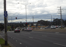 | |
Heatherton Road and Stud Road, Dandenong | |
 North end South end | |
| Coordinates |
|
| General information | |
| Type | Highway |
| Length | 30 km (19 mi) |
| Route number(s) | |
| Major junctions | |
| North end | |
| |
| South end | |
| Location(s) | |
| Major suburbs | Scoresby, Rowville, Dandenong, Carrum Downs |
| Highway system | |
Route
Dandenong Valley Highway begins at its junction with the Nepean Highway, in central Frankston. It heads as a two-lane, two-way road alongside the Frankston railway line to the Frankston Freeway. It then roughly heads north east as a four lane dual carriageway to Dandenong, the centre of which the road runs through as a four lane single carriageway. After Dandenong, the road again becomes a four lane dual carriageway, heading north, through Rowville, Scoresby and Westfield Knox shopping centre in Wantirna South. At Boronia Road in Wantirna, the road which formerly narrowed down to one lane. now continues on in its dual-carriageway form, before eventually terminating at Mountain Highway, in Bayswater.
Otherwise known as
There are a variety of street names which exceed the Dandenong Valley Highway status which includes:
- Stud Road (from Bayswater to Dandenong)
- Foster Street (within central Dandenong)
- Princes Highway (Lonsdale Street) (within central Dandenong)
- Dandenong-Frankston Road (from Dandenong to Frankston North)
- Dandenong Road West (from Frankston North to Frankston)
- Fletcher Road (within central Frankston)
Major intersections
| LGA | Location[1] | km[1] | mi | Destinations | Notes |
|---|---|---|---|---|---|
| Knox | Bayswater | 0 | 0.0 | Also known as Stud Road | |
| Wantirna | 1.1 | 0.68 | |||
| Wantirna South | 3.0 | 1.9 | |||
| 4.0 | 2.5 | ||||
| Scoresby | 6.4 | 4.0 | |||
| Rowville | 7.8 | 4.8 | Kelletts Road – Ferntree Gully | ||
| 9.8 | 6.1 | ||||
| 9.9 | 6.2 | Bergins Road – Endeavour Hills, Doveton | |||
| Greater Dandenong | Dandenong North | 12.9 | 8.0 | Brady Road | |
| 13.4 | 8.3 | ||||
| Dandenong | 14.6 | 9.1 | |||
| 15.4 | 9.6 | David Street | |||
| 16.3 | 10.1 | Clow Street – Dandenong, Doveton | Stud Street north of here, Foster Street south of here | ||
| 17.0 | 10.6 | Duplex with Lonsdale Street | |||
| 17.3 | 10.7 | Webster Street | |||
| 17.8 | 11.1 | duplex with Lonsdale Street north of here; Dandenong-Frankston Road south | |||
| 18.1 | 11.2 | Gippsland railway line | |||
| Dandenong South | 18.7 | 11.6 | |||
| 19.8 | 12.3 | ||||
| 21.8 | 13.5 | Abbotts Road | |||
| Frankston | Carrum Downs | 26.6 | 16.5 | ||
| 30.2 | 18.8 | Lathams Road / Hall Road – Carrum Downs, Cranbourne | |||
| 31.7 | 19.7 | ||||
| Frankston North | 32.3 | 20.1 | Seaford Road – Seaford / Ballarto Road – Skye | ||
| Seaford | 35.0 | 21.7 | Frankston Freeway (M3) – Hastings, Melbourne | ||
| 35.2 | 21.9 | Skye Road / Overton Road | Frankston railway line | ||
| Frankston | 36.4 | 22.6 | Young Street | Dandenong Road north of here; Fletcher Road west | |
| 36.6 | 22.7 | Bayside Shopping Centre car park | |||
| 36.8 | 22.9 | ||||
| 1.000 mi = 1.609 km; 1.000 km = 0.621 mi | |||||
See also
![]()
References
- Google (13 February 2017). "Dandenong Valley Highway" (Map). Google Maps. Google. Retrieved 13 February 2017.
Road infrastructure in Melbourne | |
|---|---|
| Freeways | |
| Highways |
|
| Bypasses | |
| Bridges and tunnels |
|
| Proposals | |
| |