St Ishmaels
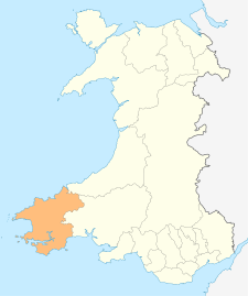
St Ishmaels or St Ishmael's (Welsh: Llanismel) is a village, parish and community close to the Milford Haven Waterway in Pembrokeshire, Wales. The community comprises most of the parish of St Ishmaels and had a population of 490 at the 2001 census.[1] The ward includes the communities of Herbrandston, Dale and Marloes and St. Brides. The community was subsequently merged with other communities and only the ward remained with the name St Ishmael's. This covers the entire peninsula with at total population at the 2011 census of 1,405.[2]
| St Ishmaels | |
|---|---|
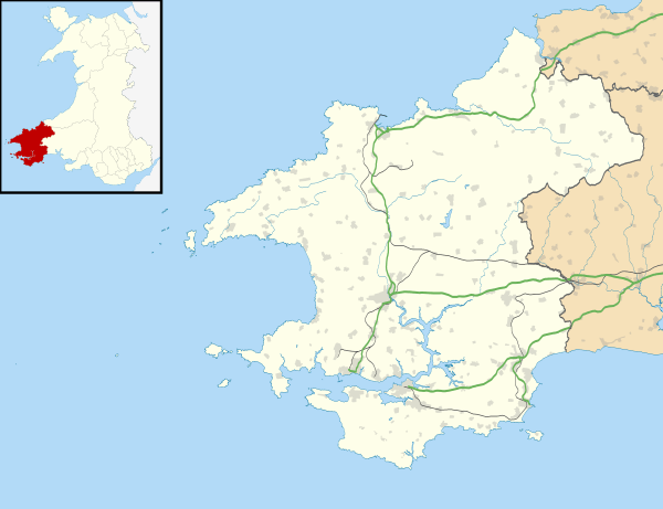 St Ishmaels Location within Pembrokeshire | |
| OS grid reference | SM899061 |
| Principal area | |
| Ceremonial county | |
| Country | Wales |
| Sovereign state | United Kingdom |
| Post town | HAVERFORDWEST |
| Postcode district | SA62 |
| Dialling code | 01646 |
| Police | Dyfed-Powys |
| Fire | Mid and West Wales |
| Ambulance | Welsh |
| UK Parliament | |
| Senedd Cymru – Welsh Parliament |
|
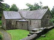
The parish church of Saint Ismael (Welsh: Isfael) is below the village, hidden in a small valley near the Haven. In the Age of the Saints, it may have been the seat of the bishop of the cantref of Rhos.[3] Llanismael was considered one of the principal dioceses of Dyfed under medieval Welsh law, second only to Menevia (modern St Davids).[4] With the Norman conquest, St Ishmaels became part of the Lordship of Haverfordwest. The church is a grade II listed building [5]
The south, west and east of the parish is bordered by the Haven with numerous important bird and marine life within the Pembrokeshire Coast Path. The north is mainly farmland used for both grazing and arable. Prince Charles's first footsteps on Welsh soil were in 1955 to the south of the village on the beach at Lindsway Bay. The royal yacht was anchored in Dale Roads.[6] The southern point of Lindsway Bay is marked by the Great Castle Head lighthouse now a private residence. The lighthouse was built in 1870, and along with the modern Little Castle Head beacon situated across Longoar Bay, serve as navigation beacons for the Rosslare-Pembroke Dock shipping route.
References
- Census 2001
- "Ward population 2011". Retrieved 21 April 2015.
- Williams, A. H., An Introduction to the History of Wales: Volume I: Prehistoric Times to 1063, UoWP, 1941, p 120
- Wade-Evans, Arthur. Medieval Welsh Law, p. 263.
- "Church of St Ishmael, St Ishmael's". British Listed Buildings. Retrieved 2 January 2014.
- https://www.bluestonewales.com/pembrokeshire/beaches/lindsway-bay