Kilgetty
Kilgetty (Welsh: Cilgeti; ![]()
Kilgetty
| |
|---|---|
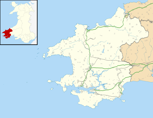
 Kilgetty Location within Pembrokeshire | |
| Population | 2,262 |
| Community | |
| Principal area | |
| Ceremonial county | |
| Country | Wales |
| Sovereign state | United Kingdom |
| Post town | KILGETTY |
| Postcode district | SA68 |
| Dialling code | 01834 |
| Police | Dyfed-Powys |
| Fire | Mid and West Wales |
| Ambulance | Welsh |
| UK Parliament | |
Community
The villages of Killgetty, Reynalton and Begelly make up the community of Killgetty/Begelly. At the 2011 Census, the population of the community was 2,011,[1] increasing to 2,262 at the 2011 Census.[2] Kilgetty's population in its own right was 1,207;[3] and Begelly 761.[4]
History
Kilgetty, in Narberth Hundred and the parish of St Issel's, was the name of an ancient mansion owned by the Picton family and was already decaying in the 19th century, according to Lewis's Topographical Dictionary of Wales published in 1833.[5]
Coal mining
The last Pembrokeshire coal mine, at Kilgetty, closed in 1950.[6]
Amenities
The village has local shopping facilities with a supermarket, newsagents, chemists, car and bicycle shop, carpet and bed shop, fish and chip shop, Chinese takeaway and Indian restaurant and takeaway.
The pub, which was called the Railway Inn, is now known as the White Horse. There is also a RAOB social club and a local sports club that has a cricket ground.
A Tang Soo Do Karate club who train at the Community centre every Monday from 6pm to 7pm; all ages and abilities are welcome.
There is a local scout group known as 1st Kilgetty. They have Scouts (ages 10.5-14 yrs), Cubs (ages 8–10.5yrs) and Beavers (ages 6–8 yrs).
St Mary's Mission Church in the village[7] closed for worship in the 1990s and is now a private residence.

Kilgetty railway station is a request stop on the West Wales Line.
References
- Davies, John; Jenkins, Nigel; Menna, Baines; Lynch, Peredur I., eds. (2008). The Welsh Academy Encyclopaedia of Wales. Cardiff: University of Wales Press. p. 437. ISBN 978-0-7083-1953-6.
- "Ward/community population 2011". Retrieved 19 April 2015.
- https://www.nomisweb.co.uk/reports/localarea?compare=W38000084
- https://www.nomisweb.co.uk/reports/localarea?compare=W38000036
- S. Lewis (1833). Topographical Dictionary of Wales. Retrieved 14 February 2019.
- "Pembrokeshire Virtual Museum - Coal Mining". Archived from the original on 24 September 2015. Retrieved 29 April 2014.
- "Coflein: St Mary's Mission Church, Kilgetty". Retrieved 6 September 2018.
External links
| Wikimedia Commons has media related to Kilgetty. |
