South Fork, Missouri
South Fork is an unincorporated community and census-designated place (CDP) in Howell County, Missouri, United States.[2] It is located 10 miles (16 km) southwest of West Plains on U.S. Route 160. As of the 2010 census, South Fork had a population of 241.[1]
South Fork, Missouri | |
|---|---|
 South Fork  South Fork | |
| Coordinates: 36°37′40″N 91°57′45″W | |
| Country | United States |
| State | Missouri |
| County | Howell |
| Area | |
| • Total | 3.5 sq mi (9.1 km2) |
| • Land | 3.5 sq mi (9.1 km2) |
| • Water | 0.0 sq mi (0.0 km2) |
| Elevation | 1,094 ft (333 m) |
| Population | |
| • Total | 241 |
| • Density | 69/sq mi (26.5/km2) |
| Time zone | UTC-6 (Central (CST)) |
| • Summer (DST) | UTC-5 (CDT) |
| Area code(s) | 417 |
| FIPS code | 29-68762[1] |
| GNIS feature ID | 0726724[2] |
A post office called South Fork was established in 1860, and remained in operation until 1960.[3] The community was named after the nearby South Fork of the Spring River.[4]
References
- "Geographic Identifiers: 2010 Census Summary File 1 (G001): South Fork CDP, Missouri". American Factfinder. U.S. Census Bureau. Archived from the original on February 13, 2020. Retrieved August 21, 2017.
- U.S. Geological Survey Geographic Names Information System: South Fork, Missouri
- "Post Offices". Jim Forte Postal History. Retrieved 10 October 2016.
- "Howell County Place Names, 1928–1945 (archived)". The State Historical Society of Missouri. Archived from the original on 24 June 2016. Retrieved 10 October 2016.CS1 maint: BOT: original-url status unknown (link)
Municipalities and communities of Howell County, Missouri, United States | ||
|---|---|---|
| Cities | 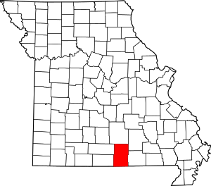 Map of Missouri highlighting Howell County | |
| Townships | ||
| CDPs | ||
| Other unincorporated communities | ||
| Ghost towns | ||
This article is issued from Wikipedia. The text is licensed under Creative Commons - Attribution - Sharealike. Additional terms may apply for the media files.