Caulfield, Missouri
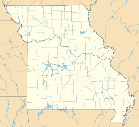
Caulfield is an unincorporated community in western Howell County, Missouri, United States.[1] It is located on U.S. Highway 160 and Missouri Route 101, approximately fifteen miles west of West Plains. The Ozark County line lies just to the west of Caulfield.[2]
Caulfield, Missouri | |
|---|---|
 Caulfield  Caulfield | |
| Coordinates: 36°36′52″N 92°06′18″W | |
| Country | United States |
| State | Missouri |
| County | Howell |
| Elevation | 1,027 ft (313 m) |
| Time zone | UTC-6 (Central (CST)) |
| • Summer (DST) | UTC-5 (CDT) |
| ZIP code | 65626 |
| Area code(s) | 417 |
| GNIS feature ID | 715508[1] |
History
A post office called Caulfield has been in operation since 1929.[3] The community takes its name from Missouri governor Henry Stewart Caulfield, who assumed office in 1929.[4]
On March 1, 2007, a tornado hit Caulfield, killing seven-year-old Caulfield resident, Elizabeth Croney.
gollark: Just touch type.
gollark: Greetings.
gollark: There are commercially available 16TB disks nowadays.
gollark: Not much of the TV or music though.
gollark: 61 days of video because video is very big.
References
- U.S. Geological Survey Geographic Names Information System: Caulfield, Missouri
- Missouri Atlas & Gazetteer, DeLorme, 1998, First edition, p. 64, ISBN 0-89933-224-2
- "Post Offices". Jim Forte Postal History. Archived from the original on 10 April 2015. Retrieved 10 October 2016.
- "Howell County Place Names, 1928–1945 (archived)". The State Historical Society of Missouri. Archived from the original on 24 June 2016. Retrieved 10 October 2016.CS1 maint: BOT: original-url status unknown (link)
Municipalities and communities of Howell County, Missouri, United States | ||
|---|---|---|
| Cities | 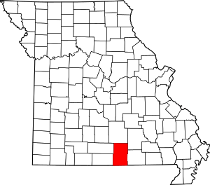 Map of Missouri highlighting Howell County | |
| Townships | ||
| CDPs | ||
| Other unincorporated communities | ||
| Ghost towns | ||
This article is issued from Wikipedia. The text is licensed under Creative Commons - Attribution - Sharealike. Additional terms may apply for the media files.