South Carolina Highway 418
South Carolina Highway 418 (SC 418) is a 24.7-mile-long (39.8 km), east-west state highway in upstate South Carolina. It runs between U.S. Route 25 (US 25) in southern Greenville County and SC 101/SC 146 in southern Spartanburg County; it also runs through northern Laurens County.
| ||||
|---|---|---|---|---|
| ||||
| Route information | ||||
| Maintained by SCDOT | ||||
| Length | 24.74 mi[1] (39.82 km) | |||
| Existed | 1949–present | |||
| Major junctions | ||||
| West end | ||||
| ||||
| East end | ||||
| Location | ||||
| Counties | Greenville, Laurens, Spartanburg | |||
| Highway system | ||||
| ||||

Route description
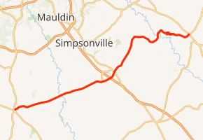
The western terminus of SC 418 is at the junction of US 25 and SC 8 in Ware Place. It then proceeds in an east-northeast direction to Fountain Inn, crossing Interstate 385 (I-385) at exit 23 before entering the city. After the interchange, the highway intersects SC 14 and takes a north-northeast route, following almost parallel to the Greenville-Laurens County border. It then cuts across the northern corner of Laurens County heading through rural areas of the county without passing any incorporated towns or intersecting any other state highways. It travels across the Enoree River to head east into Spartanburg County, and coming to its east terminus on the outskirts of Woodruff at the intersection with SC 101/SC 146.[2][3]
Major intersections
| County | Location | mi[1] | km | Destinations | Notes | |||
|---|---|---|---|---|---|---|---|---|
| Greenville | Ware Place | 0.00 | 0.00 | Eastern terminus of SC 8 | ||||
| Fountain Inn | 11.42– 11.67 | 18.38– 18.78 | Exit 23 (I-385) | |||||
| 12.31 | 19.81 | |||||||
| Laurens |
No major junctions | |||||||
| Spartanburg | | 24.74 | 39.82 | |||||
| 1.000 mi = 1.609 km; 1.000 km = 0.621 mi | ||||||||
References
- "Statewide Highways (shapefile)" (zip). South Carolina Department of Transportation. September 29, 2017. Retrieved December 8, 2017.
- Google (2010-05-08). "overview map of SC Highway 418" (Map). Google Maps. Google. Retrieved 2010-05-08.
- South Carolina DeLorme Atlas & Gazetteer, First Edition (© 1998). Pages 24–25
External links
| Wikimedia Commons has media related to South Carolina Highway 418. |