Soroti–Katakwi–Moroto–Lokitanyala Road
Soroti–Katakwi–Moroto–Lokitanyala Road is a road in the Eastern and Northern regions of Uganda. The road connects the urban centers of Soroti, the largest city in Teso sub-region, to Katakwi, the district headquarters of Katakwi District and to Moroto, the largest city in the Karamoja sub-region. It ends at Lokitanyala, at the international border with Kenya.[1]
| Soroti–Katakwi–Moroto–Lokitanyala Road | |
|---|---|
| Route information | |
| Length | 129 mi (208 km) |
| History | Completion (Soroti–Katakwi–Moroto) in 2020 |
| Major junctions | |
| South end | Soroti |
| Katakwi Napak Moroto | |
| North end | Lokitanyala |
| Highway system | |
| Roads in Uganda | |
Location
The road starts at Soroti and continues northeastwards through Katakwi, and on to Moroto. The distance between Soroti and Moroto is approximately 170 kilometres (106 mi).[2]
At Moroto, the road takes a southeasterly direction for approximately 37 kilometres (23 mi), to end at Lokitanyala, for a total road distance of 208 kilometres (129 mi).[3]
Overview
Prior to 2016 this transport corridor posed serious challenges to residents and visitors, who endured the dust and potholes during the dry season. In the rainy season the road became a bog, with vehicles stuck in the mud for days, sometimes for weeks.[4][5]
Upgrading to bitumen
In November 2016, the upgrade of the road to grade II bitumen standard, with culverts, shoulders and drainage channels began. Te work was contracted to China Communications Construction Company Limited (CCCC) and China Railway Group 3 Construction Company. The construction bill totaled USh646.8 billion (approx. US$175 million), funded by te government of Uganda and other development partners.[6]
The work on the Soroti–Katakwi–Moroto section was completed in late 2019. Official handover to the Ugandan government is expected in 2020.[7] As of January 2020, the road had been fully tarmacked from Soroti to Moroto, and was open to the public.[8] The Moroto–Lokitanyala section is expected to be tarmacked during the 2020/2021 financial year that begins in July 2020.[3]
References
- Google (30 June 2020). "Map Showing Soroti–Katakwi–Moroto–Lokitanyala Road in the Town of Katakwi" (Map). Google Maps. Google. Retrieved 30 June 2020.
- Google (30 June 2020). "Road Distance Between Soroti and Moroto in Uganda" (Map). Google Maps. Google. Retrieved 30 June 2020.
- Eninu, Edward (31 March 2019). "Delay In Construction Of Lokitanyala Road Irks Moroto Leaders". Kampala: Uganda Radio Network. Retrieved 30 June 2020.
- "Trucks Stuck For Days Along Soroti–Moroto Road" (Video). Kampala: NTV Uganda. 19 December 2015. Retrieved 30 June 2020 – via YouTube.
- "Rains cut off access to Karamoja". The Observer. Kampala. Uganda Radio Network. 9 December 2015. Retrieved 30 June 2020.
- Emwamu, Simon Peter (8 February 2019). "Tamarcked Soroti-Moroto road boosts transport, trade". Daily Monitor. Kampala. Retrieved 30 June 2020.
- Ariong, Steven (18 December 2019). "Joy As Government Completes Soroti–Moroto Highway". Daily Monitor. Kampala. Retrieved 30 June 2020.
- Ariong, Steven (17 January 2020). "New Moroto–Soroti Road Boosts Trade". Daily Monitor. Kampala. Retrieved 30 June 2020.
External links
- Uganda National Road Authority Homepage
- Government Is On Steady Progress In Road Infrastructural Development As at 11 April 2019.
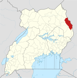
Capital: Moroto | ||
| Counties and sub-counties |
|  |
| Towns and villages | ||
| Economy |
| |
| Notable landmarks | ||
| Health | ||
| Transport | ||
Capital: Katakwi | ||
| Towns and villages | 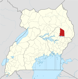 | |
| Economy | ||
| Health | ||
| Transport | ||
| Notable people | ||
Capital: Soroti | ||
| Towns and villages | 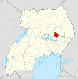 | |
| Economy |
| |
| Transport | ||
| Energy | ||
| Health |
| |
| Media |
| |
| Notable landmarks |
| |
| Education | ||
| Hospitality |
| |
| Notable people | ||