Sonora, Kentucky
Sonora is a home rule-class city in Hardin County, Kentucky, United States. The population was 513 at the 2010 census,[3] up from 350 at the 2000 census. It is included in the Elizabethtown, Kentucky Metropolitan Statistical Area.
Sonora, Kentucky | |
|---|---|
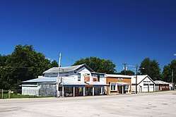
 Buildings along Main Street | |
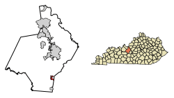
 Location of Sonora in Hardin County, Kentucky. | |
| Coordinates: 37°31′33″N 85°53′40″W | |
| Country | United States |
| State | Kentucky |
| County | Hardin |
| Area | |
| • Total | 1.36 sq mi (3.53 km2) |
| • Land | 1.36 sq mi (3.51 km2) |
| • Water | 0.01 sq mi (0.02 km2) |
| Elevation | 725 ft (221 m) |
| Population (2010) | |
| • Total | 513 |
| • Estimate (2019)[2] | 520 |
| • Density | 383.48/sq mi (148.07/km2) |
| Time zone | UTC-5 (Eastern (EST)) |
| • Summer (DST) | UTC-4 (EDT) |
| ZIP code | 42776 |
| Area code(s) | 270 & 364 |
| FIPS code | 21-71724 |
| GNIS feature ID | 0503878 |
History
Sonora began as an L&N Railroad construction camp known as "Bucksnort" in the late 1850s. This name is believed to have been inspired by the sounds of early locomotives, which the workers thought resembled deer snorts.[4] When a depot was established at the site in 1859, the name was changed to "Sonora". This may have referred to Sonora, Mexico, the home of a railroad contractor.[4]
Geography
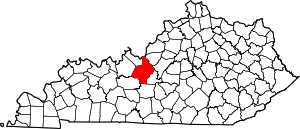
Sonora is located in southeastern Hardin County at 37°31′33″N 85°53′40″W (37.525783, -85.894373).[5] The city is concentrated around the intersection of Kentucky Route 84 and Kentucky Route 720, with its municipal boundaries stretching eastward to the Hardin-LaRue county line. Interstate 65 passes through the eastern end of the city, with access from Exit 81. I-65 leads north 13 miles (21 km) to Elizabethtown, the county seat, and south 18 miles (29 km) to Munfordville.
According to the United States Census Bureau, the city has a total area of 1.2 square miles (3.0 km2), of which 0.01 square miles (0.03 km2), or 0.98%, are water.[3]
Demographics
| Historical population | |||
|---|---|---|---|
| Census | Pop. | %± | |
| 1870 | 266 | — | |
| 1880 | 289 | 8.6% | |
| 1890 | 228 | −21.1% | |
| 1900 | 256 | 12.3% | |
| 1910 | 250 | −2.3% | |
| 1920 | 274 | 9.6% | |
| 1930 | 248 | −9.5% | |
| 1940 | 300 | 21.0% | |
| 1950 | 292 | −2.7% | |
| 1960 | 268 | −8.2% | |
| 1970 | 390 | 45.5% | |
| 1980 | 416 | 6.7% | |
| 1990 | 295 | −29.1% | |
| 2000 | 350 | 18.6% | |
| 2010 | 513 | 46.6% | |
| Est. 2019 | 520 | [2] | 1.4% |
| U.S. Decennial Census[6] | |||
At the 2000 census,[7] there were 350 people, 138 households and 85 families residing in the city. The population density was 423.3 per square mile (162.8/km2). There were 159 housing units at an average density of 192.3 per square mile (74.0/km2). The racial makeup of the city was 94.86% White, 2.86% African American, 0.29% Native American, 0.29% Asian, and 1.71% from two or more races.
There were 138 households of which 31.9% had children under the age of 18 living with them, 48.6% were married couples living together, 10.1% had a female householder with no husband present, and 37.7% were non-families. 32.6% of all households were made up of individuals and 18.8% had someone living alone who was 65 years of age or older. The average household size was 2.51 and the average family size was 3.22.
The age distribution was 26.6% under the age of 18, 8.0% from 18 to 24, 27.7% from 25 to 44, 18.6% from 45 to 64, and 19.1% who were 65 years of age or older. The median age was 36 years. For every 100 females, there were 81.3 males. For every 100 females age 18 and over, there were 86.2 males.
The median household income was $27,361 and the median family income was $37,500. Males had a median income of $28,438 and females $14,038. The per capita income was $13,554. About 6.1% of families and 10.6% of the population were below the poverty line, including 6.3% of those under age 18 and 11.9% of those age 65 or over.
References
- "2019 U.S. Gazetteer Files". United States Census Bureau. Retrieved July 24, 2020.
- "Population and Housing Unit Estimates". United States Census Bureau. May 24, 2020. Retrieved May 27, 2020.
- "Geographic Identifiers: 2010 Demographic Profile Data (G001): Sonora city, Kentucky". American Factfinder. U.S. Census Bureau. Retrieved June 27, 2017.
- Robert Rennick, Kentucky Place Names (University Press of Kentucky, 2013).
- "US Gazetteer files: 2010, 2000, and 1990". United States Census Bureau. February 12, 2011. Retrieved April 23, 2011.
- "Census of Population and Housing". Census.gov. Retrieved June 4, 2015.
- "U.S. Census website". United States Census Bureau. Retrieved January 31, 2008.
External links

