Sleetmute, Alaska
Sleetmute (Central Yupik: Cellitemiut) is a census-designated place (CDP) in Bethel Census Area, Alaska, United States. At the 2010 census the population was 86, down from 100 in 2000.
Sleetmute, Alaska Cellitemiut | |
|---|---|
 Sleetmute in the winter | |
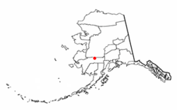 Location of Sleetmute, Alaska | |
| Coordinates: 61°41′2″N 157°9′7″W | |
| Country | United States |
| State | Alaska |
| Census Area | Bethel |
| Government | |
| • State senator | Lyman Hoffman (D) |
| • State rep. | Bryce Edgmon (D) |
| Area | |
| • Total | 105.3 sq mi (272.6 km2) |
| • Land | 99.5 sq mi (257.6 km2) |
| • Water | 5.8 sq mi (15.0 km2) |
| Population (2010) | |
| • Total | 86 |
| • Density | 0.82/sq mi (0.32/km2) |
| Time zone | UTC-9 (Alaska (AKST)) |
| • Summer (DST) | UTC-8 (AKDT) |
| ZIP codes | 99668 |
| Area code(s) | 907 |
| FIPS code | 02-71090 |
Geography and Climate
Sleetmute is located on the east bank of the Kuskokwim River, 1.5 miles north of its junction with the Holitna River. It lies 79 miles east of Aniak, 166 miles northeast of Bethel, and 243 miles west of Anchorage.[1]
According to the United States Census Bureau, the CDP has a total area of 105.3 square miles (273 km2), of which, 99.5 square miles (258 km2) of it is land and 5.8 square miles (15 km2) of it (5.49%) is water.
| Climate data for Sleetmute | |||||||||||||
|---|---|---|---|---|---|---|---|---|---|---|---|---|---|
| Month | Jan | Feb | Mar | Apr | May | Jun | Jul | Aug | Sep | Oct | Nov | Dec | Year |
| Average high °C (°F) | −12.5 (9.5) |
−6.9 (19.6) |
−4.7 (23.6) |
3.2 (37.7) |
12.7 (54.9) |
17.6 (63.7) |
18.3 (65.0) |
16.6 (61.9) |
11.6 (52.8) |
1.2 (34.2) |
−7.7 (18.2) |
−13.9 (6.9) |
3.0 (37.3) |
| Average low °C (°F) | −21.7 (−7.0) |
−17.4 (0.6) |
−17.9 (−0.3) |
−8.2 (17.2) |
1.1 (33.9) |
4.8 (40.7) |
7.6 (45.6) |
7.1 (44.7) |
1.8 (35.3) |
−7.0 (19.4) |
−14.4 (6.0) |
−22.1 (−7.7) |
−7.2 (19.0) |
| Average precipitation mm (inches) | 44 (1.73) |
15 (0.58) |
17 (0.66) |
27 (1.05) |
40 (1.59) |
52 (2.03) |
94 (3.72) |
88 (3.48) |
97 (3.81) |
37 (1.45) |
31 (1.23) |
33 (1.29) |
575 (22.62) |
| Average snowfall cm (inches) | 50 (19.7) |
21 (8.4) |
8.4 (3.3) |
11 (4.3) |
0.0 (0.0) |
0.0 (0.0) |
0.0 (0.0) |
0.0 (0.0) |
1.0 (0.4) |
0.76 (0.3) |
35 (13.8) |
41 (16.2) |
168.16 (66.4) |
| Source: http://www.wrcc.dri.edu/cgi-bin/cliMAIN.pl?ak8554 | |||||||||||||
Demographics
| Historical population | |||
|---|---|---|---|
| Census | Pop. | %± | |
| 1930 | 133 | — | |
| 1940 | 86 | −35.3% | |
| 1950 | 120 | 39.5% | |
| 1960 | 122 | 1.7% | |
| 1970 | 109 | −10.7% | |
| 1980 | 107 | −1.8% | |
| 1990 | 106 | −0.9% | |
| 2000 | 100 | −5.7% | |
| 2010 | 86 | −14.0% | |
| U.S. Decennial Census[2] | |||
Sleetmute first appeared on the 1930 U.S. Census as the unincorporated village of "Sleitmut."[3] In 1940, it returned as "Sleitmute." In 1950, and in every successive census, it has returned as Sleetmute. In 1980, it was made a census-designated place (CDP).
As of the census[4] of 2000, there were 100 people, 33 households, and 25 families residing in the CDP. The population density was 1.0 people per square mile (0.4/km2). There were 51 housing units at an average density of 0.5/sq mi (0.2/km2). The racial makeup of the CDP was 11.00% White and 89.00% Native American.
There were 33 households, out of which 33.3% had children under the age of 18 living with them, 45.5% were married couples living together, 21.2% had a female householder with no husband present, and 24.2% were non-families. 24.2% of all households were made up of individuals, and 9.1% had someone living alone who was 65 years of age or older. The average household size was 3.03 and the average family size was 3.56.
In the CDP, the population was spread out, with 33.0% under the age of 18, 8.0% from 18 to 24, 17.0% from 25 to 44, 29.0% from 45 to 64, and 13.0% who were 65 years of age or older. The median age was 37 years. For every 100 females, there were 138.1 males. For every 100 females age 18 and over, there were 109.4 males.
The median income for a household in the CDP was $15,000, and the median income for a family was $20,417. Males had a median income of $6,250 versus $0 for females. The per capita income for the CDP was $8,150. There were 47.4% of families and 57.7% of the population living below the poverty line, including 78.6% of under eighteens and 25.0% of those over 64.
References
- Alaska Division of Community Affairs, Community Information Summaries
- "U.S. Decennial Census". Census.gov. Retrieved June 6, 2013.
- "Geological Survey Professional Paper". 1949.
- "U.S. Census website". United States Census Bureau. Retrieved 2008-01-31.
Municipalities and communities of Bethel Census Area, Alaska, United States | ||
|---|---|---|
| Cities | 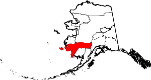 Bethel Census Area map | |
| CDPs | ||
| Unincorporated communities | ||
| Ghost towns | ||
| Authority control |
|
|---|