Arolik, Alaska
Arolik is a former Inuit settlement and ghost town in Bethel Census Area, Alaska, United States. It was located at the North mouth of Arolik River adjacent to the shore of Kuskokwim Bay.[1] The site is approximately 4 miles south of the city of Quinhagak.[2] It was first surveyed for the 1880 U.S. Census by Ivan Petroff and reported as "Agaligamute" (alternatively as "Aguliagamute").
Arolik, Alaska | |
|---|---|
Ghost Town | |
 Arolik Location in the U.S. state of Alaska | |
| Coordinates: 59°41′59″N 161°52′35″W | |
| Country | United States |
| State | Alaska |
| Census Area | Bethel |
| Elevation | 3 ft (1 m) |
| Time zone | UTC-9 (Alaska (AKST)) |
| • Summer (DST) | UTC-8 (AKDT) |
| Area code(s) | 907 |
| GNIS feature ID | 1398398 |
In 1913, it was published as "Arolic" (Arolik) by the U.S. Coast and Geodetic Survey (USC&GS) on Chart T-3399. The Inuit name was reported to mean "moon." The place is no longer permanently inhabited. This may be the site of the burnt village reported to be at the north mouth of Arolik River. The Inuit name of the Arolik River is "Aalalik," meaning "ashes," and refers to ashes of the village at its mouth. A 1951 USGS topographical map of Arolik (Goodnews Bay quadrangle)[3] showed a cluster of buildings still extant. However, by 2019, the aerial map of the location indicated no buildings present and the USGS 2017 Goodnews Bay C-8 topographical map omitted the locale entirely.[4]
The site is accessible by gravel road from Quinhagak.
Demographics
| Historical population | |||
|---|---|---|---|
| Census | Pop. | %± | |
| 1880 | 120 | — | |
| 1890 | 94 | −21.7% | |
| U.S. Decennial Census[5] | |||
Arolik[6] first appeared on the 1880 U.S. Census as the Inuit village of "Agaligamute" with 120 residents, all Inuit.[7] It returned in 1890 as "Aguliagamiut" with an all-native population.[8] This included 15 families living in 7 houses.[9] It did not report on the census again after 1890.
References
- https://geonames.usgs.gov/apex/f?p=138:3:0::NO:3:P3_FID,P3_TITLE:1398398,Arolik
- https://www.google.com/maps/dir/59.7473943,-161.9119665/59.6985661,-161.8774554/@59.7142742,-161.9043732,12379m/data=!3m2!1e3!4b1!4m2!4m1!3e2
- https://ngmdb.usgs.gov/ht-bin/tv_browse.pl?id=93b8779f17eceac6e904601069b25fb2
- https://ngmdb.usgs.gov/ht-bin/tv_browse.pl?id=e36153452cd0a6cab8c903e085233e86
- "Census of Population and Housing". Census.gov. Retrieved June 4, 2016.
- https://books.google.com/books?id=Rr9RAQAAMAAJ&pg=PA49&lpg=PA49&dq=%22Agaligamute%22&hl=en#v=onepage&q=arolik&f=false p.87
- http://www2.census.gov/prod2/decennial/documents/1880a_v1-17.pdf
- http://www2.census.gov/prod2/decennial/documents/1890a_v8-01.pdf
- https://books.google.com/books?id=-KRCAQAAMAAJ&pg=PA164&lpg=PA164&dq=%22Akgulurigiglak%22&source=bl&ots=rOhSy1f9rp&sig=6dEb88xlfpJKU31uM0rtZ0ZmFME&hl=en&sa=X&ved=0ahUKEwjN-c_h_cfUAhVDOD4KHS1RAucQ6AEIJDAB#v=onepage&q=%22Akgulurigiglak%22&f=false p.164
Municipalities and communities of Bethel Census Area, Alaska, United States | ||
|---|---|---|
| Cities | 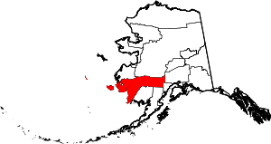 Bethel Census Area map | |
| CDPs | ||
| Unincorporated communities | ||
| Ghost towns | ||