Skirling
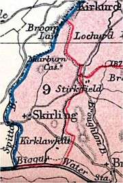
Skirling is a parish, community council area and village in Peeblesshire in the Scottish Borders situated 2½ miles east of Biggar in Lanarkshire. Biggar Water, a tributary the River Tweed forms the southern boundary of the parish with the parish of Broughton, Glenholm and Kilbucho. It is also bounded by that parish on the east, namely the Broughton part of it. On the north it is bounded by the parish Kirkurd in Peeblesshire. Spittal Burn forms most of its western boundary with Lanarkshire.[1]

| Skirling | |
|---|---|
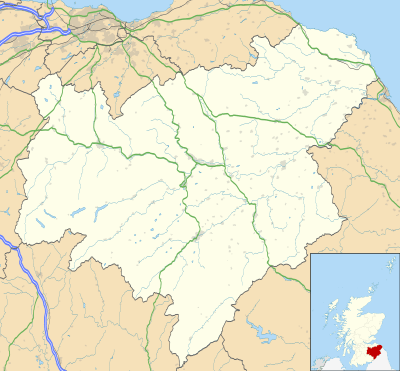
 Skirling Location within the Scottish Borders | |
| Population | 194 |
| OS grid reference | NT0753139017 |
| Council area | |
| Lieutenancy area | |
| Country | Scotland |
| Sovereign state | United Kingdom |
| Post town | Biggar |
| Postcode district | ML12 |
| Dialling code | 01721 |
| Police | Scotland |
| Fire | Scottish |
| Ambulance | Scottish |
| UK Parliament | |
| Scottish Parliament | |
The parish lies in the Southern Uplands. Its village is 690 ft above sea level. Its length, north to south, is 3 miles and it is 2 miles at most wide.[1][2] The highest point in the parish is Broomy Law, 1399 ft,[3] on the north-west boundary. At its northernmost point the parish is met by 5 other parishes (boundary stone at site).
The earliest known record of Skirling by name dates from the reign of King Robert Bruce, who granted the barony of Scrawline to John Monfode.[2] The barony of Skirling was possessed by the Cockburn family c.1370 - 1621 and during the 18th and 19th centuries by the Carmichael family.[1] Thomas Gibson-Carmichael was raised to peerage of the United Kingdom in 1912 as Baron Carmichael of Skirling, but this title became extinct on his death in 1926. He commissioned the building of Skirling House in 1905.[4]

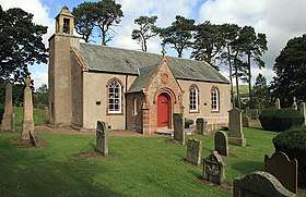
The earliest record of a church is in 1275, sited near the present war memorial.[5] Former ministers include John Greig.[6] In 1843, William Hanna left the established Church of Scotland in 1843, joining the Free Church of Scotland, taking most of his congregation with him.[7] The present building was rebuilt in 1720 and was much altered in 1891. It has a pleasant bell tower with a sundial, the bell dating from 1748.[8] Ironwork on the graveyard gates is by Thomas Hadden and the Carmichael family plot is flanked by two charming angel sculptures. The church is now a member of the linked "Parishes of Upper Tweeddale", which is made up of four neighbouring Parishes.[5]
The Skirling Community Council area is the same as the civil parish. The council has 6 members.[9]
The village of Skirling has a central position in the parish. It originally consisted of five small farms on the valley floor of Skirling Burn, forming a roughly linear shaped settlement. The village is a conservation area,[10] which includes the parish church, the old Free church, Skirling House, along with many 1 - 2 story buildings made from traditional materials. Just south-west of the village is the site of Skirling Castle, described as "ane notable beilding"[11] and demolished and burnt by Regent Moray on 12 June 1568.[1]
The village war memorial was designed by Sir Robert Lorimer and added in 1920.[12]
The civil parish has a population of 194 (in 2011) [13] and its area is 3,423 acres.[14]
References
- Ordnance Gazetteer of Scotland, by Francis Groome, 2nd edition 1896; article on Skirling
- Statistical Account of Scotland, Vol III Roxburgh, Peebles, Selkirk, publ.William Blackwood, 1845; article on Skirling (Peeblesshire section)
- Ordnance Survey 1 inch to 1 mile, Sheet 61 - Falkirk and Lanark, Publication date 1961
- Website of Historic Environment Scotland, formed in 2015 by the merger Historic Scotland and the Royal Commission on the Ancient and Historical Monuments of Scotland (RCAHMS): canmore.org.uk/site/97985 - retrieved Oct 2016
- Church of Scotland website www.uppertweeddale.org.uk retrieved Oct 2016
- Scott, Hew (1915). Fasti ecclesiae scoticanae; the succession of ministers in the Church of Scotland from the reformation. 1. Edinburgh: Oliver and Boyd. pp. 257-259. Retrieved 17 March 2019.

- . Dictionary of National Biography. London: Smith, Elder & Co. 1885–1900.CS1 maint: ref=harv (link)
- Historic Environment Scotland web site portal.historicenvironment.scot/designation/LB15153; retrieved Oct 2016
- Scottish Borders Community Council web site www.scotborders.gov.uk/downloads/file/1025/skirling; retrieved Oct 2016
- Scottish Borders council web site www.scotborders.gov.uk/directory_record/26011/skirling - Retrieved Oct 2016
- Calendar State Papers Scotland, vol. 2 (Edinburgh, 1900), pp. 444-5.
- Dictionary of Scottish Architects: Robert Lorimer
- Census of Scotland 2011, Table KS101SC – Usually Resident Population, publ. by National Records of Scotland. Web site http://www.scotlandscensus.gov.uk/ retrieved March 2016. See “Standard Outputs”, Table KS101SC, Area type: Civil Parish 1930
- Gazetteer of Scotland, publ, by W & AK Johnston, Edinburgh, 1937. Article on Skirling. Places are presented alphabetically