Silver Springs, Calgary
Silver Springs is a residential neighbourhood in the northwest quadrant of Calgary, Alberta. It is bounded to the north by Crowchild Trail, to the east by Sarcee Trail, to the south by the Bow River and to the west by Nose Hill Drive. The Silver Springs golf course is developed in the eastern part of the community, and the Bowmont Natural Area borders the community to the south.
Silver Springs | |
|---|---|
Neighbourhood | |
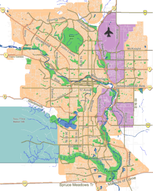
 Silver Springs Location of Silver Springs in Calgary | |
| Coordinates: 51°06′22″N 114°11′19″W | |
| Country | |
| Province | |
| City | |
| Quadrant | NW |
| Ward | 1 |
| Established | 1980 |
| Government | |
| • Mayor | Naheed Nenshi |
| • Administrative body | Calgary City Council |
| • Councillor | Ward Sutherland |
| Area | |
| • Total | 3.4 km2 (1.3 sq mi) |
| Elevation | 1,130 m (3,710 ft) |
| Population (2006)[2] | |
| • Total | 9,329 |
| • Average Income | $73,776 |
| Website | [3] |
Silver Springs was developed between 1972 and 1980. It is represented in the Calgary City Council by the Ward 1 councillor.[1]
Demographics
In the City of Calgary's 2012 municipal census, Silver Springs had a population of 8,933 living in 3,533 dwellings, a 0.3% increase from its 2011 population of 8,910.[4] With a land area of 5 km2 (1.9 sq mi), it had a population density of 1,790/km2 (4,600/sq mi) in 2012.[4][5]
Residents in this community had a median household income of $73,776 in 2000, and there were 5.8% low income residents living in the neighbourhood.[6] As of 2000, 16.7% of the residents were immigrants. A proportion of 9.1% of the buildings were condominiums or apartments, and 15.9% of the housing was used for renting.[2]
Education
The community is served by Silver Springs Elementary and W.O. Mitchell Elementary public schools, as well as by St. Sylvester Elementary School (Catholic). It is also served by St Vincent de Paul Catholic school in Varsity.
The Ravine
The section of the "Bowmont Natural Area" which forms the Southern border of the community is commonly known to Silver Springs residents as "The Ravine" or "The Gully" and is a popular recreational area.
Businesses and Organizations
Silver Springs supports two commercial centres, one at the western end of the primary thoroughfare, Silver Springs Boulevard, and the other just north of the gully. The latter features a pub currently titled the Silver Point, but better remembered by locals as Suds 'n' Spuds.
A Calgary Police Station once formed part of the plaza. A police officer lost his life in a training accident at the station in the early 2000s.
See also
References
- "Calgary Elections". City of Calgary. 2017. Retrieved November 12, 2017.
- City of Calgary (2006). "Silver Springs Community Statistics" (PDF). Retrieved 2007-05-16.
- http://www.silverspringscommunity.ca
- "2012 Civic Census Results" (PDF). City of Calgary. 2012. Retrieved February 4, 2013.
- "Community Boundaries" (Esri shapefile). City of Calgary. Retrieved February 5, 2013.
- City of Calgary (2004). "Ward 1 Profile" (PDF). Archived from the original (PDF) on 2007-08-09. Retrieved 2007-05-16.