Downtown West End, Calgary
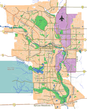
The Downtown West End is a neighbourhood within the western portions of downtown Calgary, Alberta, Canada. It is bounded to the north by the Bow River, to the east by 9th Street W, to the south by the CPR Tracks and to the west by 14th Street W.
Downtown West End | |
|---|---|
Neighbourhood | |
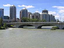
 Condominiums in the Downtown West End | |
 Downtown West End Location of Downtown West End in Calgary | |
| Coordinates: 51°02′50″N 114°05′10″W | |
| Country | |
| Province | |
| City | |
| Quadrant | SW |
| Ward | 8 |
| Established | 1884 |
| Government | |
| • Mayor | Naheed Nenshi |
| • Administrative body | Calgary City Council |
| • Councillor | Evan Woolley |
| Elevation | 1,050 m (3,440 ft) |
| Population (2006)[2] | |
| • Total | 2,681 |
| • Average Income | $47,964 |
| Website | Downtown West End Community Association |
West End is a high density residential community, largely made up of condominiums and apartment buildings, with only 25 single-family detached homes remaining in the neighbourhood.
Downtown Calgary was established as a neighbourhood in 1884, after the arrival of the Canadian Pacific Railway in 1883.[3] It is represented in the Calgary City Council by the Ward 8 councillor, on a provincial level by Calgary-Buffalo MLA Kent Hehr, and at federal level by Calgary Centre MP Lee Richardson.
Attractions

The Shaw Millennium Park and Mewata Armouries are located in the western area of the neighbourhood, while paved multi-use (bicycle, walking, rollerblading, etc.) paths line the northern rim along the Bow River.
The Downtown West - Kerby C-Train station serves the community. Downtown West End is also well connected into the Plus 15 skywalk system.
Demographics
In the City of Calgary's 2012 municipal census, Downtown West End had a population of 2,322 living in 1,628 dwellings, a -6.5% increase from its 2011 population of 2,483.[4] With a land area of 0.4 km2 (0.15 sq mi), it had a population density of 5,800/km2 (15,000/sq mi) in 2012.[5][4]
Residents in this community had a median household income of $47,964 in 2000, and there were 25.6% low income residents living in the neighbourhood.[6] As of 2000, 20.2% of the residents were immigrants. A proportion of 93.4% of the buildings were condominiums or apartments, and 53.9% of the housing was used for renting.[2]
See also
References
- "Calgary Elections". City of Calgary. 2017. Retrieved November 12, 2017.
- City of Calgary (2006). "Downtown West End Community Statistics" (PDF). Archived from the original (PDF) on 2008-04-11. Retrieved 2007-05-22.
- Calgary Communities. "Downtown West Community Association". Archived from the original on 2007-05-29. Retrieved 2007-05-23.
- "2012 Civic Census Results" (PDF). City of Calgary. 2012. Retrieved February 4, 2013.
- "Community Boundaries" (Esri shapefile). City of Calgary. Retrieved February 5, 2013.
- City of Calgary (2004). "Ward 8 Profile" (PDF). Archived from the original (PDF) on 2007-08-09. Retrieved 2007-05-22.