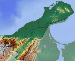
Siamaná Formation
The Siamaná Formation (Spanish: Formación Siamaná, E3s) is a fossiliferous geological formation of the Cocinetas Basin in the northernmost department of La Guajira. The formation consists of conglomerates and limestones. The Siamaná Formation dates to the Paleogene period; Middle to Late Oligocene epoch, corresponding to the Deseadan in the SALMA classification.
| Siamaná Formation Stratigraphic range: Mid-Late Oligocene ~28–23 Ma | |
|---|---|
| Type | Geological formation |
| Unit of | Cocinetas Basin |
| Underlies | Uitpa Formation |
| Overlies | Macarao Formation |
| Thickness | 430 m (1,410 ft) |
| Lithology | |
| Primary | Conglomerate |
| Other | Limestone |
| Location | |
| Coordinates | 11°58′00″N 71°22′43″W |
| Region | La Guajira Caribbean region |
| Country | |
| Type section | |
| Named for | Siamaná |
| Named by | Renz |
| Location | Uribia |
| Year defined | 1960 |
| Coordinates | 11°58′00″N 71°22′43″W |
| Region | La Guajira |
| Country | |
 Type locality of the formation in La Guajira | |
Etymology
The formation was defined by Renz in 1960 and named after the village of Siamaná.[1]
Description
Lithologies
The Siamaná Formation consists of conglomerates and thick carbonates.[2]
Stratigraphy and depositional environment
The Siamaná Formation, with a maximum thickness of 430 metres (1,410 ft), overlies the Macarao Formation and is overlain by the Uitpa Formation. The age has been estimated to be Middle to Late Oligocene, corresponding to the Deseadan in the SALMA classification. The depositional environment has been interpreted as shallow marine.[3]
Petroleum geology
The Siamaná Formation is a reservoir and seal rock formation in the Guajira Basin.[4]
Fossil content
| Group | Fossils | Notes |
|---|---|---|
| Invertebrates | Mimachlamys canalis, Ostrea sp. | |
See also
References
- Moreno et al., 2015, p.7
- Hendy et al., 2015, p.47
- Rodríguez & Londoño, 2002, p.132
- ANH, 2010
- Hendy et al., 2015, p.50
Bibliography
Local geology
- ANH, .. 2010. Guajira Basin - Colombia Open Round 2010, 1. ANH. Accessed 2017-08-30.
- Moreno, F.; A.J.W. Hendy; L. Quiroz; N. Hoyos; D.S. Jones; V. Zapata; S. Zapata; G.A. Ballen, and Edwin Cadena, A.L. Cárdenas, J.D. Carrillo Briceño, J.D. Carrillo, D. Delgado Sierra, J. Escobar, J.I. Martínez, C. Martínez, C. Montes, J. Moreno, N. Pérez, R. Sánchez, C. Suárez, M.C. Vallejo Pareja, C. Jaramillo. 2015. Revised stratigraphy of Neogene strata in the Cocinetas Basin, La Guajira, Colombia. Swiss Journal of Palaeontology 134. 5–43. Accessed 2017-08-08.
- Rodríguez, Gabriel, and Ana Cristina Londoño. 2002. Mapa geológico del Departamento de La Guajira - 1:250,000, 1–259. INGEOMINAS. Accessed 2017-08-08.
Paleontology
- Hendy, Austin J.W.; Douglas S. Jones; Federico Moreno; Vladimir Zapata, and Carlos Jaramillo. 2015. Neogene molluscs, shallow marine paleoenvironments, and chronostratigraphy of the Guajira Peninsula, Colombia. Swiss Journal of Palaeontology 134. 45–75. Accessed 2017-08-08.
Maps
- Zuluaga, Carlos A.; Alberto Ochoa; Carlos A. Muñoz; Camilo E. Dorado; Nathalia M. Guerrero; Ana M. Martínez; Paula A. Medina; Edgar F. Ocampo, and Alejandro Pinilla and Paula A. Ríos, Bibiana P. Rodríguez, Edward A. Salazar, Vladimir L. Zapata. 2008. Plancha 3 - Puerto Estrella - 1:100,000, 1. INGEOMINAS. Accessed 2017-06-06.
- Zuluaga, Carlos A.; Alberto Ochoa; Carlos A. Muñoz; Camilo E. Dorado; Nathalia M. Guerrero; Ana M. Martínez; Paula A. Medina; Edgar F. Ocampo, and Alejandro Pinilla and Paula A. Ríos, Bibiana P. Rodríguez, Edward A. Salazar, Vladimir L. Zapata. 2008. Plancha 5 - Bahía Portete - 1:100,000, 1. INGEOMINAS. Accessed 2017-06-06.
- Zuluaga, Carlos A.; Alberto Ochoa; Carlos A. Muñoz; Camilo E. Dorado; Nathalia M. Guerrero; Ana M. Martínez; Paula A. Medina; Edgar F. Ocampo, and Alejandro Pinilla and Paula A. Ríos, Bibiana P. Rodríguez, Edward A. Salazar, Vladimir L. Zapata. 2008. Plancha 10 - Rancho Grande - 1:100,000, 1. INGEOMINAS. Accessed 2017-06-06.
- Zuluaga, Carlos A.; Alberto Ochoa; Carlos A. Muñoz; Camilo E. Dorado; Nathalia M. Guerrero; Ana M. Martínez; Paula A. Medina; Edgar F. Ocampo, and Alejandro Pinilla and Paula A. Ríos, Bibiana P. Rodríguez, Edward A. Salazar, Vladimir L. Zapata. 2008. Plancha 10bis - Rancho Grande - 1:100,000, 1. INGEOMINAS. Accessed 2017-06-06.