Shawbury
Shawbury is a village and civil parish in the English county of Shropshire.[1] The village is 8.4 miles (13.5 km) north east of the town of Shrewsbury, 11.5 miles (18.5 km) north west of Telford and 163 miles (262 km) north west of London.
| Shawbury | |
|---|---|
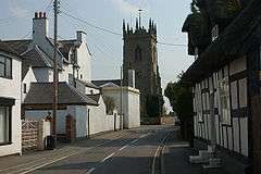 Shawbury parish church from the village | |
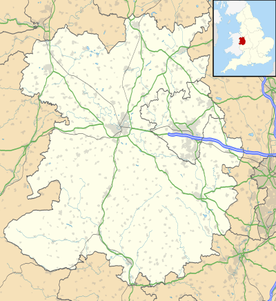 Shawbury Location within Shropshire | |
| Population | 2,872 (2011) |
| OS grid reference | SJ550210 |
| • London | 163 miles (262 km) |
| Civil parish |
|
| Unitary authority | |
| Ceremonial county | |
| Region | |
| Country | England |
| Sovereign state | United Kingdom |
| Post town | SHREWSBURY |
| Postcode district | SY4 |
| Dialling code | 01939 |
| Police | West Mercia |
| Fire | Shropshire |
| Ambulance | West Midlands |
| UK Parliament | |
The village straddles the A53 between Shrewsbury and Market Drayton.[2] The nearest railway station is at Yorton on the Welsh Marches Line for Shrewsbury/Crewe. The 2011 census recorded a population of 2,872 for the entire civil parish of Shawbury.[3]
History
Shawbury has an entry in the Domesday Book of 1085.[4] In the great book Shawbury is recorded by the name Sawesberie. The main landholders was Gerard from Earl Roger of Shrewsbury. The survey also mentions that there is church and a mill.
Geography
The River Roden flows through the village. The village of Moreton Corbet, with its castle, is just to the north. The main weather station for Shropshire is located in the village, at the RAF base.[5] On 13 December 1981 a temperature of -25.2 °C was recorded, one of the coldest on record for England.[6]
| Climate data for Shawbury | |||||||||||||
|---|---|---|---|---|---|---|---|---|---|---|---|---|---|
| Month | Jan | Feb | Mar | Apr | May | Jun | Jul | Aug | Sep | Oct | Nov | Dec | Year |
| Average high °C (°F) | 7.2 (45.0) |
7.5 (45.5) |
10.1 (50.2) |
12.7 (54.9) |
16.0 (60.8) |
18.8 (65.8) |
21.0 (69.8) |
20.6 (69.1) |
17.9 (64.2) |
13.9 (57.0) |
10.0 (50.0) |
7.2 (45.0) |
13.6 (56.4) |
| Average low °C (°F) | 0.8 (33.4) |
0.6 (33.1) |
2.3 (36.1) |
3.5 (38.3) |
6.5 (43.7) |
9.3 (48.7) |
11.3 (52.3) |
11.1 (52.0) |
9.1 (48.4) |
6.3 (43.3) |
3.2 (37.8) |
0.9 (33.6) |
5.4 (41.7) |
| Average rainfall mm (inches) | 56.3 (2.22) |
39.0 (1.54) |
46.5 (1.83) |
49.1 (1.93) |
53.5 (2.11) |
53.4 (2.10) |
53.9 (2.12) |
59.4 (2.34) |
57.2 (2.25) |
67.8 (2.67) |
61.5 (2.42) |
62.3 (2.45) |
659.9 (25.98) |
| Source 1: Met Office[7] | |||||||||||||
| Source 2: Met Office - RAF Shawbury (1971–2000 averages) RAF Shawbury is located approximately 7 miles (11 km) NE of Shrewsbury, and 12 miles (19 km) NW of Telford. | |||||||||||||
Governance
An electoral ward in the same name exists. This ward covers much of the surrounding area with a total ward population as taken at the 2011 Census of 4,666.[8]
Landmarks
There has been a church on this site since at least the 12th century, although the present church is not from that date. Many air force personnel from RAF Shawbury, an air station founded in 1917, are buried in the churchyard, which contains 32 Commonwealth War Graves, 3 from World War I and 29 from World War II, besides 7 Polish Air Force personnel from the latter war.[9]
The village is home to RAF Shawbury, a helicopter airfield for the Royal Air Force of the United Kingdom and home of the tri-services Defence Helicopter Flying School. Shawbury's football club is Shawbury United F.C.
Notable people
- Thomas Charles (1755-1814), later Calvinistic Methodist minister and founder of the British and Foreign Bible Society, worked in Shawbury in 1783-84 as assistant to then rector, friend John Mayor [10]
- William Hazledine (1763–1840) an English ironmaster, he was a pioneer in casting structural ironwork, most notably for canal aqueducts and early suspension bridges
- Lieutenant-General Sir Richard Butler (1870-1935) a British Army general during WW1, lived in retirement at Roden Lodge where he died.[11]
Bus service
Shawbury is served by the 64 route, operated by Arriva Midlands North, which runs between Shrewsbury and Market Drayton.
See also
References
- OS Explorer Map 241, Shrewsbury, Wem, Shawbury & Baschurch. ISBN 978-0-319-46276-8
- Shrewsbury & Telford Street Atlas, ISBN 978-1-84348-389-2
- Neighbourhood Statistics Census 2011 - Shawbury CP
- The Domesday Book, Englands Heritage, Then and Now, Editor: Thomas Hinde, Shropshire, Shawbury, page 230, ISBN 1-85833-440-3
- Observations Archived 2012-02-10 at the Wayback Machine
- https://blog.metoffice.gov.uk/2012/10/16/top-ten-coldest-recorded-temperatures-in-the-uk/
- "Shawbury 1981–2010 averages". UK government. Met Office. Retrieved 14 June 2016.
- "Ward population 2011". Retrieved 30 November 2015.
- CWGC Cemetery Report. Breakdown of figures obtained from count of casualty list accompanying.
- . Encyclopædia Britannica. 05 (11th ed.). 1911.
- "A Famous General's Death – Sir R.H.K.Butler, of Shawbury". Shrewsbury Chronicle. 26 April 1935. p. 7. Both the Dictionary of National Biography and Oxford Dictionary of National Biography are erroneous in stating he died in Shrewsbury.
External links
