Shackleton Range
The Shackleton Range is a mountain range in Antarctica. Rising at Holmes Summit to 1,875 metres (6,152 ft), it extends in an east–west direction for about 160 kilometres (99 mi) between the Slessor and Recovery glaciers.[1]
| Shackelton Range | |
|---|---|
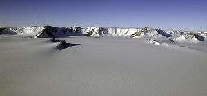
 The Shackleton Range, just out of the ice sheet between Slessor and Recovery glaciers. | |
| Highest point | |
| Elevation | 1,875 m (6,152 ft) |
| Geography | |
 Shackelton Range Location in Antarctica | |
The range was named after Sir Ernest Shackleton, leader of the British Imperial Trans-Antarctic Expedition (or "Shackleton's Expedition") of 1914–16.[1]
Surveys
The Commonwealth Trans-Antarctic Expedition (CTAE), which in 1956 saw the range from the air, conducted a ground-level survey of its western part in 1957. The United States Navy photographed the range from the air in 1967. In 1968–69 and 1969–70, the British Antarctic Survey (based at Halley Station) conducted further ground surveys with support from US Navy C-130 Hercules aircraft.[1]
Geology
The Haskard Group and Turnpike Bluff Group rest unconformably on the Archean-Middle Proterozoic Shackleton Range Metamorphic Complex. The Ordovician-Early Devonian Blaiklock Glacier Group (475 Ma) also unconformably overlies the Shackleton Range Metamorphic Complex. This group is composed of sandstones and conglomerates, and is unconformably overlain by the Beacon Supergroup.[2]
Features
Geographical features include:
Herbert Mountains
Read Mountains
Du Toit Nunataks
Other features
La Grange Nunataks
Other features
- Aronson Corner
- Baines Nunatak
- Bergan Castle
- Blaiklock Glacier
- Blanchard Hill
- Chevreul Cliffs
- Clarkson Cliffs
- Clayton Ramparts
- Cornwall Glacier
- Crossover Pass
- Flat Top
- Freshfield Nunatak
- Fuchs Dome
- Genghis Hills
- Gordon Glacier
- Guyatt Ridge
- Haskard Highlands
- Honnywill Peak
- Jackson Tooth
- Lewis Chain
- Lindqvist Nunatak
- Lister Heights
- Lord Nunatak
- Lundström Knoll
- MacQuarrie Edge
- M'Clintock Bastion
- Meade Nunatak
- Mount Dewar
- Mount Greenfield
- Mount Haslop
- Mount Homard
- Mount Lowe (Antarctica)
- Mount Pivot
- Mount Provender
- Mount Sheffield
- Mount Skidmore
- Mount Weston
- Mummery Cliff
- Nostoc Lake
- Petersen Peak
- Pioneers Escarpment
- Pointer Nunatak
- Pratts Peak
- Ram Bow Bluff
- Recovery Glacier
- Sauria Buttress
- Shotton Snowfield
- Slessor Glacier
- Stephenson Bastion
- Stratton Glacier
- Turnpike Bluff
- Warden Pass
- Wedge Ridge
- Whymper Spur
- Williams Ridge
References
- "Shackleton Range". Geographic Names Information System. United States Geological Survey. Retrieved 2004-10-31.
- Laird, M.G. (1991). Thomson, M.R.A.; Crame, J.A.; Thomson, J.W. (eds.). Lower-mid-Palaeozoic sedimentation and tectonic patterns on the palaeo-Pacific margin of Antarctica, in Geological Evolution of Antarctica. Cambridge: Cambridge University Press. pp. 178–179. ISBN 9780521372664.
.svg.png)