Severn Stoke
Severn Stoke is an English village and civil parish in the Malvern Hills District, in the south of the county of Worcestershire, alongside the A38 trunk road. It had a population of 611 in 2011.[1]
| Severn Stoke | |
|---|---|
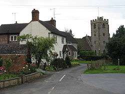
 Church and old houses | |
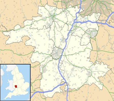
 Severn Stoke Location within Worcestershire | |
| OS grid reference | SO857441 |
| Civil parish |
|
| District |
|
| Shire county | |
| Region | |
| Country | England |
| Sovereign state | United Kingdom |
| Post town | WORCESTER |
| Postcode district | WR8 |
| Police | West Mercia |
| Fire | Hereford and Worcester |
| Ambulance | West Midlands |
| UK Parliament | |
Heritage
In 1996 a hoard of 18 silver Saxon pennies were found near Severn Stoke.
Severn Stoke was within the bounds of the Royal forest of Horewell during the medieval period. The woodlands were mostly removed around the time of the Civil War.[2]
Severn Stoke War Memorial at the corner of Ham Lane and Church is a Grade II listed monument in the form of a Classical obelisk in Portland stone, unveiled in 1920. It lists 14 servicemen who died in the First World War, 82 others who served abroad, and 15 who served at home.[3]
Notable people
- Moses Browne, poet and devotional writer, born in 1704.[4]
Amenities
The village has a pub and restaurant, the Rose & Crown in Church Lane, which occupies a 15th-century half-timbered building in a garden.[5] There is a village hall with wheelchair access in Ham Lane.[6] The nearest shopping facilities are in Upton-upon-Severn (3 miles, 4.8 km).
Church
The Anglican parish church is dedicated to St Denys. It forms part of the parish of Kempsey in the Diocese of Worcester.[7]
The Grade II* listed church is built of grey rubble masonry throughout and dates mainly from the 14th and 15th centuries, but was restored in 1872 and 1890. The building consists of a nave with a south aisle and porch, a transept on the south side of the church, a tower on the north side, and a chancel. There are Romanesque carved fragments set into the chancel walls both inside and out, and reset into a niche on the N side of the nave; the niche has an arched head.[8][9]
Schools
The local primary school closed in 1979.[10] The nearest primary schools today are at Kempsey and Upton-upon-Severn.[11]
Public transport
The village has occasional daytime buses to and from Worcester and Upton upon Severn from Monday to Saturday.[12]
The nearest railway station is at Great Malvern (10 miles, 16.1 km), with hourly services to Birmingham and to London Paddington, and two-hourly weekday services to Bristol Temple Meads. (Though Severn Stoke was never connected to the railway, a highly detailed 00 gauge model can be seen, based on what the station may have looked like if there had been one.)[13]
References
- Figure taken from 2011 census. Retrieved 13 January 2020.
-
- 'Parishes: Pershore, St Andrew with Defford and Wick', A History of the County of Worcester: Volume 4, ed. William Page and J W Willis-Bund (London, 1924), pp. 163–177 Accessed 30 August 2015.
- Historic England Retrieved 24 August 2018.
- English Poetry 1579–1830 Retrieved 23 August 2018.
- Own website Retrieved 23 August 2018.
- Own site Retrieved 23 August 2018.
- Kempsey, Severn Stoke, Croome Retrieved 23 August 2018.
- Listed buildings Retrieved 24 August 2018.
- Romanesque architecture Retrieved 23 August 2018.
- National Archives Retrieved 24 August 2018.
- Schools guide Retrieved 24 August 2018.
- Bus Times Retrieved 23 August 2018.
- Severn Stoke Model Railway Archived 2012-03-08 at the Wayback Machine Website