Sarankhola Upazila
Sarankhola (Bengali: শরণখোলা) is an Upazila of Bagerhat District[1] in the Division of Khulna, Bangladesh.
Sarankhola শরণখোলা | |
|---|---|
Upazila | |
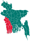
 Sarankhola Location in Bangladesh | |
| Coordinates: 22°17.5′N 89°47.5′E | |
| Country | |
| Division | Khulna Division |
| District | Bagerhat District |
| Area | |
| • Total | 756.61 km2 (292.13 sq mi) |
| Population (1991) | |
| • Total | 107,856 |
| • Density | 140/km2 (370/sq mi) |
| Time zone | UTC+6 (BST) |
| Postal code | 9311 |
| Website | sarankhola |
Geography
Sarankhola is located at 22.2917°N 89.7917°E . It has 19588 households and total area 756.61 km2.
Demographics
As of the 1991 Bangladesh census, Sarankhola has a population of 107856. Males constitute 51.28% of the population, and females 48.72%. This Upazila's eighteen up population is 52157. Sarankhola has an average literacy rate of 41.8% (7+ years), and the national average of 32.4% literate.[2]
Administration
Sarankhola has 4 Unions/Wards, 11 Mauzas/Mahallas, and 44 villages.
gollark: Bees approach.
gollark: No, this is also not possible unless you just somehow reverse the last bit.
gollark: Well, we can brute force each bit separately I think.
gollark: Oh. Hmm. It isn't 32 bits of output.
gollark: The entire hash is a few tens of arithmetic operations in total, and there are 2^32 possible outputs, so it should be bruteforceable quite fast.
See also
- Upazilas of Bangladesh
- Districts of Bangladesh
- Divisions of Bangladesh
References
- Md. Moshfequr Rahman (2012), "Sarankhola Upazila", in Sirajul Islam and Ahmed A. Jamal (ed.), Banglapedia: National Encyclopedia of Bangladesh (Second ed.), Asiatic Society of BangladeshCS1 maint: uses authors parameter (link)
- "Population Census Wing, BBS". Archived from the original on 2005-03-27. Retrieved November 10, 2006.
| Upazila/Thana: | ||
|---|---|---|
This article is issued from Wikipedia. The text is licensed under Creative Commons - Attribution - Sharealike. Additional terms may apply for the media files.