Magura District
Magura (Bengali: মাগুরা) is a district in south-western Bangladesh. It is a part of the Khulna Division.[3] Magura is far from Dhaka by 176 kilometers. The main transport is bus. From Magura to Dhaka it takes five hours by bus. There is no train transport in Magura.
Magura মাগুরা | |
|---|---|
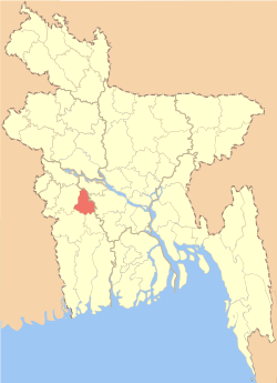 Location of Magura District in Bangladesh | |
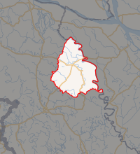
Expandable map of Magura District | |
| Coordinates: 23.40°N 89.40°E | |
| Country | |
| Division | Khulna Division |
| Area | |
| • Total | 1,048.61 km2 (404.87 sq mi) |
| Population (2011 census) | |
| • Total | 918,419 |
| • Density | 880/km2 (2,300/sq mi) |
| Literacy rate | |
| • Total | 50.6%[1] |
| Time zone | UTC+06:00 (BST) |
| Postal code | 7600 |
| HDI (2018) | 0.622[2] medium · 5th of 21 |
Administration
Magura district has 4 upazilas. They are:
Geography
Magura District (Khulna Division) with an area of 1048 km2, is bounded by Rajbari district to the north, Jessore and Narail districts to the south, Faridpur district to the east and Jhenaidaha district to the west.
Climate
| Climate data for Magura | |||||||||||||
|---|---|---|---|---|---|---|---|---|---|---|---|---|---|
| Month | Jan | Feb | Mar | Apr | May | Jun | Jul | Aug | Sep | Oct | Nov | Dec | Year |
| Average high °C (°F) | 23.4 (74.1) |
27.7 (81.9) |
33.3 (91.9) |
35.6 (96.1) |
34.8 (94.6) |
32.4 (90.3) |
31.4 (88.5) |
31.4 (88.5) |
32.2 (90.0) |
31.4 (88.5) |
28.9 (84.0) |
25.5 (77.9) |
30.7 (87.2) |
| Daily mean °C (°F) | 16.4 (61.5) |
20.2 (68.4) |
26.0 (78.8) |
29.2 (84.6) |
29.6 (85.3) |
28.9 (84.0) |
28.4 (83.1) |
28.6 (83.5) |
28.8 (83.8) |
27.3 (81.1) |
23.2 (73.8) |
18.7 (65.7) |
25.4 (77.8) |
| Average low °C (°F) | 9.4 (48.9) |
12.8 (55.0) |
18.7 (65.7) |
22.9 (73.2) |
24.5 (76.1) |
25.5 (77.9) |
25.5 (77.9) |
25.8 (78.4) |
25.6 (78.1) |
23.3 (73.9) |
17.5 (63.5) |
12.0 (53.6) |
20.3 (68.5) |
| Average precipitation mm (inches) | 11 (0.4) |
19 (0.7) |
40 (1.6) |
85 (3.3) |
183 (7.2) |
323 (12.7) |
302 (11.9) |
288 (11.3) |
242 (9.5) |
156 (6.1) |
25 (1.0) |
7 (0.3) |
1,681 (66) |
| Average relative humidity (%) | 45 | 35 | 32 | 48 | 66 | 74 | 75 | 74 | 71 | 66 | 47 | 44 | 56 |
| Source: National newspapers | |||||||||||||
Notable residents
- Muhammad Sohrab Hossain, one of the founding fathers of Bangladesh and President of the first ever meeting in the Jessore District after the Liberation of Bangladesh.
- Farrukh Ahmed, poet
- M. Khalilur Rahman, former Chief Engineer, Ministry of Works
- Syed Ali Ahsan, poet
- Kazi Kader Newaj, poet
- Mir Hasem Ali, elected as an MLA of East Bengal Legislative Assembly in 1954.
- Syed Ator Ali, elected as an MPA of East Pakistan Provincial Assembly in 1970, a Political Convenor of Sector No. 8 and 9 during Liberation War.
- M Yousuff Ali, fisheries biologist, policy planner, administrator and advocate for protecting the open water fishery resources.
- Mohammad Asaduzzaman, elected as an MP of Jatiya Sangsad for 3 times.
- Kazi Salimul Haque Kamal, two-term Member of Parliament for Magura-2
- Shakib Al Hasan, cricketer
- Kamrul Laila Jolly, former Member of Parliament
- Gangadhar Sen Roy, Ayurveda physician and Sanskrit scholar
- Biren Sikder, State Minister of Youth and Sports
- Saifuzzaman Shikhor, current MP of Magura-1
gollark: You are enacting it
gollark: START
gollark: Unacceptable. We must launch bees.
gollark: Who thought that was a good idea?
gollark: How did that proposal *happen*?
References
| Wikimedia Commons has media related to Magura District. |
- "Community Report: Magura" (PDF). Population & Housing Census 2011. Bangladesh Bureau of Statistics. p. 19. Retrieved 10 June 2017.
- "Sub-national HDI - Area Database - Global Data Lab". hdi.globaldatalab.org. Retrieved 2020-03-18.
- Abu Naser Majnu (2012). "Magura District". In Sirajul Islam and Ahmed A. Jamal (ed.). Banglapedia: National Encyclopedia of Bangladesh (Second ed.). Asiatic Society of Bangladesh.
| Upazila/Thana: | ||
|---|---|---|
| Barisal Division |
|  |
|---|---|---|
| Chittagong Division | ||
| Dhaka Division | ||
| Khulna Division | ||
| Mymensingh Division | ||
| Rajshahi Division | ||
| Rangpur Division | ||
| Sylhet Division | ||
This article is issued from Wikipedia. The text is licensed under Creative Commons - Attribution - Sharealike. Additional terms may apply for the media files.