Salina Township, Kankakee County, Illinois
Salina Township is one of seventeen townships in Kankakee County, Illinois, USA. As of the 2010 census, its population was 1,396 and it contained 537 housing units.[2] It was formed from part of Limestone Township on April 7, 1854.
Salina Township | |
|---|---|
 Location in Kankakee County | |
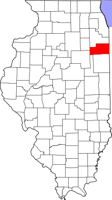 Kankakee County's location in Illinois | |
| Coordinates: 41°10′N 88°4′W | |
| Country | United States |
| State | Illinois |
| County | Kankakee |
| Established | April 7, 1854 |
| Government | |
| • Supervisor | Jerald Dau |
| Area | |
| • Total | 36.59 sq mi (94.8 km2) |
| • Land | 36.59 sq mi (94.8 km2) |
| • Water | 0 sq mi (0 km2) 0% |
| Elevation | 617 ft (188 m) |
| Population (2010) | |
| • Estimate (2016)[1] | 1,350 |
| • Density | 38.1/sq mi (14.7/km2) |
| Time zone | UTC-6 (CST) |
| • Summer (DST) | UTC-5 (CDT) |
| ZIP codes | 60481, 60901, 60913, 60935, 60941 |
| FIPS code | 17-091-67262 |
Geography
According to the 2010 census, the township has a total area of 36.59 square miles (94.8 km2), all land.[2]
Cities, towns, villages
Unincorporated towns
- Frielings at 41.166°N 88.113°W
(This list is based on USGS data and may include former settlements.)
Adjacent townships
- Rockville Township (northeast)
- Limestone Township (east)
- Pilot Township (south)
- Essex Township (west)
- Custer Township, Will County (northwest)
Cemeteries
The township contains these three cemeteries: Beach, Bonfield and Maple Grove.
Major highways
Airports and landing strips
- Hawker Airport
Landmarks
Government
The township is governed by an elected Town Board of a Supervisor and four Trustees. The Township also has an elected Assessor, Clerk, Highway Commissioner and Supervisor. The Township Office is located at 3388 North 10000 West Road, Bonfield, IL 60913.
Political districts
- Illinois' 11th congressional district
- State House District 75
- State Senate District 38
School districts
- Herscher Community Unit School District 2
gollark: I can enchant my sunglasses though, SOMEHOW.
gollark: I tried enchanting my boots with depth strider, but alas, it failed.
gollark: So you used HAXXXXX??!??!?!?!?!
gollark: Do you have much "of" a design in mind?
gollark: Can I help with "this" "university" somehow?
References
- "Salina Township, Kankakee County, Illinois". Geographic Names Information System. United States Geological Survey. Retrieved 2010-02-20.
- United States Census Bureau 2007 TIGER/Line Shapefiles
- United States National Atlas
- "Population and Housing Unit Estimates". Retrieved June 9, 2017.
- "Population, Housing Units, Area, and Density: 2010 - County -- County Subdivision and Place -- 2010 Census Summary File 1". United States Census. Archived from the original on 2020-02-12. Retrieved 2013-05-28.
- "Census of Population and Housing". Census.gov. Retrieved June 4, 2016.
External links
Municipalities and communities of Kankakee County, Illinois, United States | ||
|---|---|---|
| Cities | Map of Illinois highlighting Kankakee County | |
| Villages | ||
| Townships | ||
| Unincorporated communities | ||
| Footnotes | ‡This populated place also has portions in an adjacent county or counties. | |
This article is issued from Wikipedia. The text is licensed under Creative Commons - Attribution - Sharealike. Additional terms may apply for the media files.