Sakai, Ibaraki
Sakai (境町, Sakai-machi) is a town located in Ibaraki Prefecture, Japan. As of September 2015, the town had an estimated population of 24,598, and a population density 528 persons per km². The total area is 46.59 km².
Sakai 境町 | |
|---|---|
Town | |
_town_office01.JPG) Sakai Town Hall | |
 Flag  Seal | |
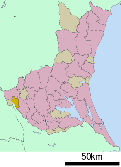 Location of Sakai in Ibaraki Prefecture | |
 Sakai | |
| Coordinates: 36°06′30.5″N 139°47′41.8″E | |
| Country | Japan |
| Region | Kantō |
| Prefecture | Ibaraki |
| District | Sashima |
| Area | |
| • Total | 46.59 km2 (17.99 sq mi) |
| Population (September 2015) | |
| • Total | 24,598 |
| • Density | 528/km2 (1,370/sq mi) |
| Time zone | UTC+9 (Japan Standard Time) |
| - Tree | Osmanthus fragrans |
| - Flower | Canna |
| Phone number | 0280-81-1300 |
| Address | 391-1 Sakai-machi, Sashima-gun, Ibaraki-ken 306-0495 |
| Website | http://www.town.sakai.ibaraki.jp/ |
Geography
Sakai is located in the flatlands in the very western portion of Ibaraki Prefecture, bordered by Chiba Prefecture to the west. The Tone River, passes through the town.
Neighboring municipalities
- Ibaraki Prefecture
- Chiba Prefecture
History
The area of present-day Sakai was part of Shimōsa Province and was transferred to Ibaraki Prefecture in 1875 after the start of the Meiji period. The area was organized into the town of Sakai with the establishment of the municipalities system on April 1, 1889.
Economy
Education
Sakai has five elementary schools, two middle school and one high school
Transportation
Railway
At present, the town is not served by any passenger railway line.
Highway
.png)

Noted people from Sakai
- Kishirō Nakamura – politician
Sister city
References
- PIO Department (6 March 2018). "Mayor of Sakai Town in Japan, Other Officials, Visit Sister City Marikina". Marikina City. Marikina City. Retrieved 1 July 2018.
External links
| Wikimedia Commons has media related to Sakai, Ibaraki. |
- Official Website (in Japanese)
Mito (capital) | ||
| Core city | ||
| Special city | ||
| Cities | ||
| Districts | ||
| Authority control |
|
|---|