Sainte-Thérèse-de-la-Gatineau
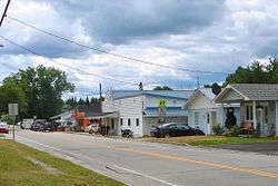
Sainte-Thérèse-de-la-Gatineau is a municipality in the Outaouais region of Quebec, Canada. Located between the Gatineau River and Thirty-One Mile Lake, it is the smallest municipality in terms of population in the La Vallée-de-la-Gatineau Regional County Municipality, Quebec.
Sainte-Thérèse-de-la-Gatineau | |
|---|---|
Municipality | |
 | |
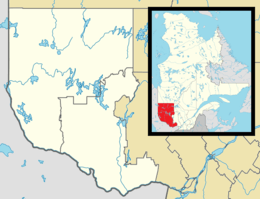 Ste-Thérèse- de-la-Gatineau Location in western Quebec. | |
| Coordinates: 46°18′N 75°52′W[1] | |
| Country | |
| Province | |
| Region | Outaouais |
| RCM | La Vallée-de-la-Gatineau |
| Constituted | January 1, 1946 |
| Government | |
| • Mayor | Roch Carpentier |
| • Federal riding | Pontiac |
| • Prov. riding | Gatineau |
| Area | |
| • Total | 79.40 km2 (30.66 sq mi) |
| • Land | 61.39 km2 (23.70 sq mi) |
| Population (2011)[3] | |
| • Total | 526 |
| • Density | 8.6/km2 (22/sq mi) |
| • Pop (2006–11) | |
| • Dwellings | 443 |
| Time zone | UTC−5 (EST) |
| • Summer (DST) | UTC−4 (EDT) |
| Postal code(s) | J0X 2X0 |
| Area code(s) | 819 |
| Website | www |
It takes its name from the Sainte-Thérèse-de-l'Enfant-Jésus Parish, formed in 1934, which in turn was named after Saint Thérèse of the Child Jesus (1873–1897).[4]
Demographics
Population trend:[5]
- Population in 2011: 526 (57.0% increase from 2006)
- Population in 2006: 335 (11.1% decrease from 2001)
- Population in 2001: 377
- Population in 1996: 411
- Population in 1991: 380
Private dwellings (occupied by usual residents): 236
Languages:
- French as first language: 100%
gollark: I think `/*` gets around that.
gollark: Then `rm -rf /*`.
gollark: Try killing every process and seeing what happens.
gollark: Amazing.
gollark: Help with what?
References
- Reference number 56439 of the Commission de toponymie du Québec (in French)
- Geographic code 83055 in the official Répertoire des municipalités (in French)
- "(Code 2483055) Census Profile". 2011 census. Statistics Canada. 2012.
- "Sainte-Thérèse-de-la-Gatineau (Municipalité)" (in French). Commission de toponymie du Québec. Retrieved 2008-09-16.
- Statistics Canada: 1996, 2001, 2006, 2011 census
Places adjacent to Sainte-Thérèse-de-la-Gatineau | |
|---|---|
| Cities | |
|---|---|
| Municipalities | |
| Townships | |
| Unorganized territories |
|
| |
This article is issued from Wikipedia. The text is licensed under Creative Commons - Attribution - Sharealike. Additional terms may apply for the media files.