Saint-Roch, Quebec City
Saint-Roch is a downtown neighbourhood in the borough of La Cité in Québec City, Québec, Canada that serves as the central business district. Once a working-class quarter, some of its parts have been redeveloped in recent years.[1].
History

Saint-Roch was first settled in 1620 by the Recollects, who built a small church dedicated to Saint Roch.[2] Today the Église Saint-Roch is the largest in Quebec City. Later, a few houses were built near what is now the Gare du Palais.[3] In the first half of the 19th century, Saint-Roch was a shipbuilding site. Later, the district saw the development of retail and manufacturing activity. From the mid-19th century to the 1960s, the rue Saint-Joseph was the principal commercial street in Quebec City.[3] In the 1960s, with shoppers attracted to suburban shopping centres, a good part of the street was covered with a roof of concrete and plexiglass in 1974.[4] Many loiterers were present in the mall, especially during cold weather, and it was slightly ill-famed. The decision to progressively demolish the roof (and thus the mall) was taken in the 1990s, and the destruction was completed in 2007[5] (which led to increased commercial activity.)[6].
.jpg)
During the second half of the 20th century, the district fell into decline and was considered the most deprived in the city. However, Since the year 2000, 380 million dollars have been invested in the district to renovate and reconstruct most of the buildings in rue Saint-Joseph.[3]
Many working-class residential buildings, representing one tenth of the area of Saint-Roch, were demolished in 1972 to make way for an overpass of highway 440 (Dufferin-Montmorency segment), as a way to accommodate the post-Second World War suburban expansion and automobile use. The empty lot on which the concrete pillars were built was eventually appropriated by citizens, especially for exposition of public art, and later for illegal graffiti and authorized large-scale trompe-l'œil murals. This unofficial area was called Îlot Fleurie (fr), because of nearby Fleurie street. It was also a socializing place for protesters during the 2001 Summit of the Americas[7], as well as where the Cirque du Soleil free show Les Chemins invisibles was held many times during the summers of 2010 to 2012.
Gallery
- The Rothmans tobacco factory in the background
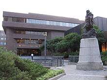
 Quebec city's central Gabrielle Roy library
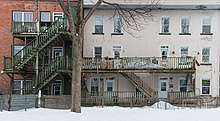
 Some older houses bordering the Dufferin-Montmorency autoroute (440)
 INRS building
 The commercial Saint-Joseph street
References
- "Saint-Roch Neighborhood". Retrieved 4 January 2014.
- Morisset, Lucie K. (2001). La mémoire du paysage : histoire de la forme urbaine d'un centre-ville ; Saint-Roch, Québec. [Sainte-Foy, Québec]: Presses de l'Université Laval. p. 19. ISBN 9782763777245. Retrieved 16 August 2015.
- "Le quartier". Retrieved 4 January 2014.
- Revitalisation du centre-ville de Québec - Le dernier hiver du Mail Saint-Roch
- Toponymie : Saint-Joseph Archived 2011-08-28 at the Wayback Machine
- Nantel, Marie-Josée. "Hugo Boss dans St-Roch: une "erreur d'implantation"". Le Soleil. Retrieved 4 January 2014.
- Hatvany, Matthew (2005). "The "Totem Poles" of Saint-Roch: Graffiti, Material Culture and the Re-Appropriation of a Popular Landscape". Material Culture Review / Revue de la culture matérielle. Retrieved 2018-11-16.
