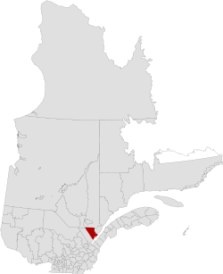
Charlevoix Regional County Municipality
Charlevoix is a regional county municipality in the Capitale-Nationale region of Quebec, Canada. The seat is Baie-Saint-Paul.
Charlevoix Regional County Municipality Municipalité Regionale de Comté de Charlevoix | |
|---|---|
 | |
| Coordinates: 47°29′N 70°29′W[1] | |
| Country | |
| Province | |
| Region | Capitale-Nationale |
| Effective | January 1, 1982 |
| County seat | Baie-Saint-Paul |
| Government | |
| • Type | Prefecture |
| • Prefect | Dominic Tremblay |
| Area | |
| • Total | 3,912.20 km2 (1,510.51 sq mi) |
| • Land | 3,763.22 km2 (1,452.99 sq mi) |
| Population (2016)[3] | |
| • Total | 12,997 |
| • Density | 3.5/km2 (9/sq mi) |
| • Change 2011-2016 | |
| • Dwellings | 7,330 |
| Time zone | UTC−5 (EST) |
| • Summer (DST) | UTC−4 (EDT) |
| Area code(s) | 418 and 581 |
| Website | www |
| [4] | |
Subdivisions
There are 7 subdivisions within the RCM:[2]
|
|
|
|
Transportation
Access routes
Highways and numbered routes that run through the municipality, including external routes that start or finish at the county border:[5]
gollark: Apioforms are almost *maximally* popular on Urban Dictionary.
gollark: FEAR.
gollark: They generally go for rounder numbers above purchasing power parity.
gollark: No idea.
gollark: osmarks.net costs an entire £18/year (yes, I'm rounding).
References
- Reference number 141111 of the Commission de toponymie du Québec (in French)
- Geographic code 160 in the official Répertoire des municipalités (in French)
- "Census Profile, 2016 Census: Charlevoix, Municipalité régionale de comté [Census division], Quebec". Statistics Canada. Retrieved December 10, 2019.
- "(Code 2416) Census Profile". 2011 census. Statistics Canada. 2012.
- Official Transport Quebec Road Map
Adjacent Counties & Equivalent Territories | |
|---|---|
| Regional county municipalities and equivalent territories | |
|---|---|
| Municipalities | |
This article is issued from Wikipedia. The text is licensed under Creative Commons - Attribution - Sharealike. Additional terms may apply for the media files.