Saint-Genest-sur-Roselle
Saint-Genest-sur-Roselle (Occitan: Sent Giniés) is a commune in the Haute-Vienne department in the Nouvelle-Aquitaine region in west-central France.
Saint-Genest-sur-Roselle | |
|---|---|
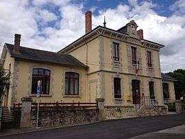 The town hall in Saint-Genest-sur-Roselle | |
Location of Saint-Genest-sur-Roselle 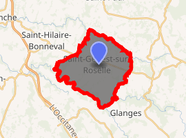
| |
 Saint-Genest-sur-Roselle  Saint-Genest-sur-Roselle | |
| Coordinates: 45°42′14″N 1°25′37″E | |
| Country | France |
| Region | Nouvelle-Aquitaine |
| Department | Haute-Vienne |
| Arrondissement | Limoges |
| Canton | Condat-sur-Vienne |
| Government | |
| • Mayor (2014–2020) | Jean-François Duchet |
| Area 1 | 19.22 km2 (7.42 sq mi) |
| Population (2017-01-01)[1] | 520 |
| • Density | 27/km2 (70/sq mi) |
| Time zone | UTC+01:00 (CET) |
| • Summer (DST) | UTC+02:00 (CEST) |
| INSEE/Postal code | 87144 /87260 |
| Elevation | 270–421 m (886–1,381 ft) |
| 1 French Land Register data, which excludes lakes, ponds, glaciers > 1 km2 (0.386 sq mi or 247 acres) and river estuaries. | |
Geography
The Roselle, a tributary of the Briance, forms most of the commune's northern border; the Briance forms all of its southern border.
gollark: =tex <:urn:627264769195245578><:thunking:570387193290293284><:thonking:570312812916637696><:printedpage:478293474098020353><:pocketsimple:478293474085437450><:pocketadvanced:478293474030911499><:neuralinterface:478293474047819777><:monitorbasic:478291787505467392><:monitoradvanced:478291787035967492><:modemender:478291787300208661>
gollark: == (tau + pi) / 2
gollark: Good mathbot.
gollark: == tau
gollark: =wolf 7.00000000000000000000001
References
- "Populations légales 2017". INSEE. Retrieved 6 January 2020.
| Wikimedia Commons has media related to Saint-Genest-sur-Roselle. |
| Authority control |
|
|---|
This article is issued from Wikipedia. The text is licensed under Creative Commons - Attribution - Sharealike. Additional terms may apply for the media files.