Oradour-Saint-Genest
Oradour-Saint-Genest (Occitan: Orador Sent Genès) is a commune in the Haute-Vienne department in the Nouvelle-Aquitaine region in west-central France.
Oradour-Saint-Genest | |
|---|---|
 The lantern of the dead, in Oradour-Saint-Genest | |
Location of Oradour-Saint-Genest 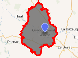
| |
 Oradour-Saint-Genest  Oradour-Saint-Genest | |
| Coordinates: 46°14′21″N 1°02′09″E | |
| Country | France |
| Region | Nouvelle-Aquitaine |
| Department | Haute-Vienne |
| Arrondissement | Bellac |
| Canton | Châteauponsac |
| Government | |
| • Mayor (2008–2014) | Gilles Reynaud |
| Area 1 | 37.90 km2 (14.63 sq mi) |
| Population (2017-01-01)[1] | 333 |
| • Density | 8.8/km2 (23/sq mi) |
| Time zone | UTC+01:00 (CET) |
| • Summer (DST) | UTC+02:00 (CEST) |
| INSEE/Postal code | 87109 /87210 |
| Elevation | 160–249 m (525–817 ft) |
| 1 French Land Register data, which excludes lakes, ponds, glaciers > 1 km2 (0.386 sq mi or 247 acres) and river estuaries. | |
Geography
The river Brame flows northwestward through the commune.
gollark: The CODING™ and ALGORITHMS™ run `SELECT * FROM reminders WHERE expired = 0 AND remind_timestamp < ?` every minute on loop, you see.
gollark: As you can see, the documentation clearly states that reminders are only checked once per minute.
gollark: ++help remind
gollark: ++remind 29/03/2021 Start Gollark's good-intentioned plan.
gollark: I don't know.
References
- "Populations légales 2017". INSEE. Retrieved 6 January 2020.
| Wikimedia Commons has media related to Oradour-Saint-Genest. |
| Authority control |
|
|---|
This article is issued from Wikipedia. The text is licensed under Creative Commons - Attribution - Sharealike. Additional terms may apply for the media files.