Saint-Chamarand
Saint-Chamarand is a commune in the Lot department in south-western France.
Saint-Chamarand | |
|---|---|
Location of Saint-Chamarand 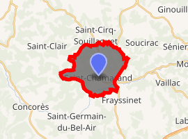
| |
 Saint-Chamarand  Saint-Chamarand | |
| Coordinates: 44°40′46″N 1°27′42″E | |
| Country | France |
| Region | Occitanie |
| Department | Lot |
| Arrondissement | Gourdon |
| Canton | Causse et Bouriane |
| Intercommunality | Quercy-Bouriane |
| Government | |
| • Mayor (2001–2008) | Yvette Delmas |
| Area 1 | 13.09 km2 (5.05 sq mi) |
| Population (2017-01-01)[1] | 187 |
| • Density | 14/km2 (37/sq mi) |
| Time zone | UTC+01:00 (CET) |
| • Summer (DST) | UTC+02:00 (CEST) |
| INSEE/Postal code | 46253 /46310 |
| Elevation | 213–384 m (699–1,260 ft) (avg. 320 m or 1,050 ft) |
| 1 French Land Register data, which excludes lakes, ponds, glaciers > 1 km2 (0.386 sq mi or 247 acres) and river estuaries. | |
Geography
The river Céou flows westward through the southern part of the commune.
gollark: #a has <#457999277311131649>, various other channels via ABR-EB, DNS input, and the ffbm webhook I think.
gollark: There is also a DNS bridge going to <#457999277311131649>.
gollark: You're still banned.
gollark: <@!293066066605768714> I implemented the thing.
gollark: Yes, all are to.
See also
References
- "Populations légales 2017". INSEE. Retrieved 6 January 2020.
| Wikimedia Commons has media related to Saint-Chamarand. |
| Authority control |
|
|---|
This article is issued from Wikipedia. The text is licensed under Creative Commons - Attribution - Sharealike. Additional terms may apply for the media files.