Lhospitalet
Lhospitalet is a commune in the Lot department in south-western France.
Lhospitalet | |
|---|---|
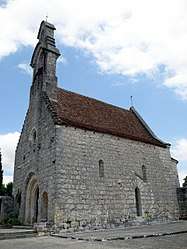 The church in Lhospitalet | |
Location of Lhospitalet 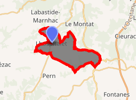
| |
 Lhospitalet  Lhospitalet | |
| Coordinates: 44°21′43″N 1°24′32″E | |
| Country | France |
| Region | Occitanie |
| Department | Lot |
| Arrondissement | Cahors |
| Canton | Marches du Sud-Quercy |
| Intercommunality | Quercy Blanc |
| Government | |
| • Mayor (2001–2008) | Jean-Claude Bessou |
| Area 1 | 14.65 km2 (5.66 sq mi) |
| Population (2017-01-01)[1] | 496 |
| • Density | 34/km2 (88/sq mi) |
| Time zone | UTC+01:00 (CET) |
| • Summer (DST) | UTC+02:00 (CEST) |
| INSEE/Postal code | 46172 /46170 |
| Elevation | 217–330 m (712–1,083 ft) |
| 1 French Land Register data, which excludes lakes, ponds, glaciers > 1 km2 (0.386 sq mi or 247 acres) and river estuaries. | |
Geography
The Barguelonne forms part of the commune's southern border.
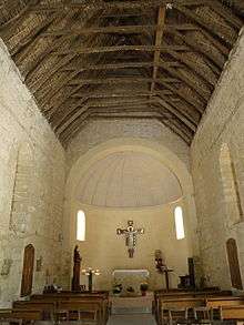
Church
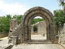
Ruins of the old Hospital
gollark: <@356209633313947648> If you want to add a road, you'll need to install Govos then ask keanu for the other bit. If you're creating a city "from scratch" or whatever then I'd actually recommend CCSS more (the chorus city street sign system).
gollark: Especially not 600 lines of SQL.
gollark: <@115156616256552962> Enmap is absolutely not a replacement for SQL.
gollark: <@356209633313947648> The street *sign* system?
gollark: <@!509348730156220427> Maybe if you stop making one version a day, your work would go faster.
See also
References
- "Populations légales 2017". INSEE. Retrieved 6 January 2020.
| Wikimedia Commons has media related to Lhospitalet. |
| Authority control |
|
|---|
This article is issued from Wikipedia. The text is licensed under Creative Commons - Attribution - Sharealike. Additional terms may apply for the media files.