Séniergues
Séniergues is a commune in the Lot department in south-western France.
Séniergues | |
|---|---|
Location of Séniergues 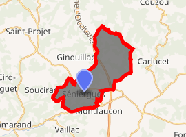
| |
 Séniergues  Séniergues | |
| Coordinates: 44°42′04″N 1°32′51″E | |
| Country | France |
| Region | Occitanie |
| Department | Lot |
| Arrondissement | Gourdon |
| Canton | Causse et Bouriane |
| Intercommunality | Communauté de communes du Causse de Labastide-Murat |
| Government | |
| • Mayor (2001–2008) | Huguette Monestier |
| Area 1 | 18.17 km2 (7.02 sq mi) |
| Population (2017-01-01)[1] | 131 |
| • Density | 7.2/km2 (19/sq mi) |
| Time zone | UTC+01:00 (CET) |
| • Summer (DST) | UTC+02:00 (CEST) |
| INSEE/Postal code | 46304 /46240 |
| Elevation | 223–425 m (732–1,394 ft) (avg. 320 m or 1,050 ft) |
| 1 French Land Register data, which excludes lakes, ponds, glaciers > 1 km2 (0.386 sq mi or 247 acres) and river estuaries. | |
Geography
The river Céou has its source in the commune and forms part of its southern border.
gollark: Huh, these compression ratios are surprisingly good for small data.
gollark: What is ”scene”?
gollark: Software was probably about the same perceptible speed.
gollark: Maybe it is just a rebranded calculator of a mildly different model. Maybe it was a secret prototype stolen from the factory which ended up in your hands through an unlikely series of coincidences. Maybe the documentation was deleted by accident. Maybe it's fake.
gollark: Why specifically 2009?
See also
References
- "Populations légales 2017". INSEE. Retrieved 6 January 2020.
| Wikimedia Commons has media related to Séniergues. |
| Authority control |
|
|---|
This article is issued from Wikipedia. The text is licensed under Creative Commons - Attribution - Sharealike. Additional terms may apply for the media files.